16
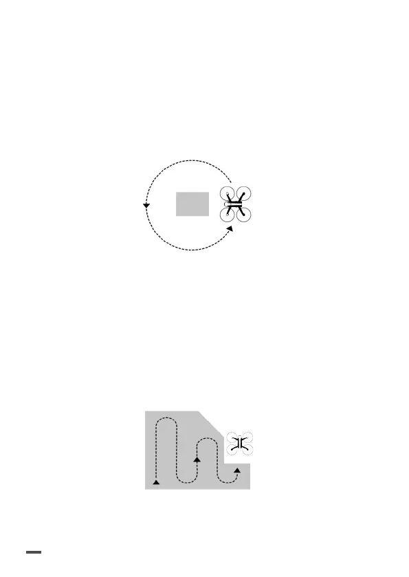
Circular: the drone performs a circular flight of the
area defined on the screen according to the itinerary
displayed. This plight plan is used to create a 3D image
reconstruction of a building.
> Plan for sufficient space around the building to be
recorded in order to ensure maximum quality of
3D reconstruction of facades.
Polygon*: the drone performs a grid flight of the
area drawn on the screen according to the itinerary
displayed. This flight plan is used to create a 3D
reconstruction of a complex shaped piece of land.
FreeFlight**: the drone is manually piloted, image
recording is automated. This plight plan is especially
used to create a 3D reconstruction of a vertical surface.
 Loading...