77
ITALIANO
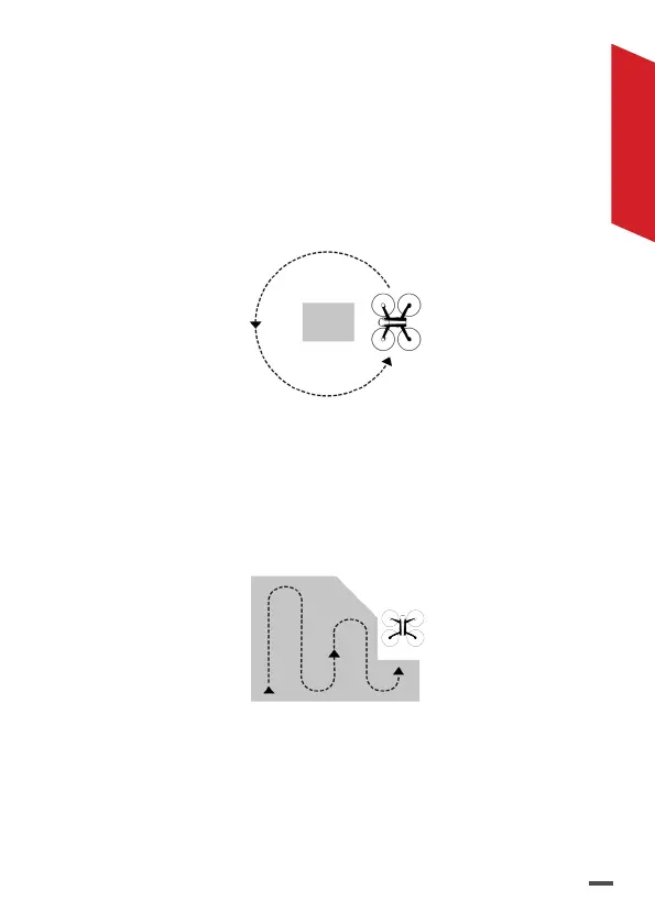
Circular: il drone circonda l'area definita sullo schermo
secondo il percorso visualizzato. Questo piano di volo
viene utilizzato per effettuare una ricostruzione 3D di
un edificio.
> Prevedi un margine intorno all'edificio da catturare
per massimizzare la qualità della ricostruzione
delle facciate.
Polygon *: il drone quadriglia l'area definita sullo
schermo secondo il percorso visualizzato. Questo piano
di volo viene utilizzato per effettuare una ricostruzione
3D su un terreno di forma complessa.
FreeFlight **: Il drone viene pilotato manualmente,
lo scatto è automatizzato. Questo piano di volo viene
utilizzato principalmente per la ricostruzione 3D di una
superficie verticale.
 Loading...