9.10Chartselection
Youcanselectthecartographytypetobeusedin
theChartapplication.TheChartselectionapplies
totheactiveChartinstance.Youmusthavethe
necessarycartographychartcardsinsertedintoyour
multifunctiondisplayinordertodisplaydifferent
cartographytype.
SelectingtheCartographytype
Youcanselectthecartographytypeyouwantto
displayintheChartapplication.
Ensureyouhaveinsertedthechartcardthat
containsthecartographytypeyouwanttodisplay.
FromtheChartapplicationmenu:
1.SelectChartSettings.
2.SelectChartSelection.
Alistofavailablecartographyisdisplayed.
3.Selectthecartographytypeyouwanttodisplay
TheChartwindowisre-drawntoshowtheselect
cartographytype.
9.11ChartDetail
Thechartdetailsettingdeterminestheamountof
detailshownintheChartapplication.
SelectingtheLowoptionfortheChartDetail
disablesthefollowingobjects:
•CommunityLayer
•ChartText
•ChartBoundaries
•LightSectors
•RoutingSystems
•CautionAreas
•MarineFeatures
•LandFeatures
•PanoramicPhoto
•Roads
•AdditionalWrecks
•ColorSeabedAreas
•DepthContours
Changingthelevelofchartdetail
Youcanchangethelevelofdetail,displayedinthe
Chartapplication.
InMotionmode:
1.PresstheOKbutton.
TheChartapplicationmenuisdisplayed.
2.SelectChartSettings.
3.SelectChartDetail.
SelectingChartDetailswitchedthedetail
betweenHighandLow.
86
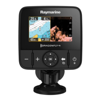
Dragony–4/Dragony–5/Dragony–7/Wi–Fish
 Loading...