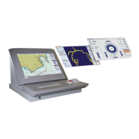
Do you have a question about the Raytheon Pathfinder ECDIS and is the answer not in the manual?
| Brand | Raytheon |
|---|---|
| Model | Pathfinder ECDIS |
| Category | Marine Equipment |
| Language | English |
Describes how ECDIS displays chart types, scales, and their sources.
Details legal equivalence and regulation for S57 and CM93/3 chart types.
Explains the provision and distribution service for Electronic Navigational Charts (ENC).
Describes Admiralty Raster Chart Service (ARCS) charts and their raster data format.
Details the Digital Nautical Chart (DNC) features as a vector-based digital database.
ECDIS Menu Bar Navigation
ECDIS Toolbar Functions
ECDIS Information Panel Content
ECDIS Operator Panel Functions
Procedure for powering on and starting the ECDIS software.
Step-by-step guide to powering on and initiating the ECDIS software.
Instructions for properly closing the ECDIS application and exiting the session.
Explains how to move and use the cursor with the trackball and its buttons.
Description of the operator panel keys and their functions for common operations.
Details methods for activating commands using keyboard shortcuts and keystroke combinations.
How to select functions from the displayed pulldown menus.
Methods for closing menus using the trackball or keyboard.
Explains the components of dialog boxes like option buttons, text boxes, and command buttons.
Details the circular ship symbol, its fixed size, and when it is displayed.
Describes the rectangular ship symbol that adjusts to chart scale.
Describes how chart boundaries and uncovered areas are visually represented.
Lists and describes the commands available in the Main Menu.
Details the functions accessible through the Chart Menu.
Details chart types, scale layers, and overlapping chart resolution criteria.
Information on obtaining and using CM93/3 chart licenses.
Procedure for viewing the user permit and registration number for IHO S63 licenses.
How to display and highlight ARCS chart updates using Show Updates and Indicate Updates.
Options for ARCS charts: Chart Information, View Chart Notes, Notices, Warnings, Updates.
Applies the Standard Symbol Presentation according to IHO-S52.
Details commands for zooming, scaling, viewing areas, and managing display elements.
Step-by-step guide on how to zoom into a specific area of the display.
Procedure to modify the display's scale and center coordinates.
Steps to save the current display settings as a named area.
Procedure to activate or deactivate the ship auto-center feature.
Instructions for selecting color schemes like Bright Sun, Day, Dusk, and Night.
Lists commands for ship info, navigation device selection, and position monitoring.
Procedure to enable dead reckoning using course and speed inputs.
Steps to change ship position via ARPA targets or manual coordinate input.
Details the True Heading (black) and Course Made Good (orange) vectors.
Sophisticated route planning with automatic checks for safe passage.
Step-by-step guide to creating a new route by adding waypoints and specifying coordinates.
Procedure to send specific chart objects like depth contours to the radar.
Procedure to activate track control, selecting waypoints and confirming settings.
Procedure to define the width of the distance-to-run interval.
Adjusts the time for the alarm when approaching a wheel-over-point.
Lists commands for bearing lines, route calculations, datum transformation, and position fixing.
Procedure to measure range and bearing between two points on the display.
Calculates reaching individual path points via a preset speed.
Procedure to define the width of the distance-to-run interval.
Commands for drawing, merging, exporting, and importing plot layer objects.
Lists commands for viewing the 12-hour logs and managing voyage recordings.
Lists commands for integrating navigation devices, AIS, Radar, Autopilot, and sensors.
Lists abbreviations (Talker IDs) for navigation devices that may appear in the data monitor.
Procedure to open the AIS Options dialog for changing target display settings.
Procedure to assign a custom label of up to 10 characters to a radar target.
Lists commands for accessing help index, system information, and about ECDIS.
Provides details on messages like Anchor Watch, Depth Too Shallow, Guard Zone, and Mode Mismatch.
Outlines requirements for official paper charts and raster data substitution.