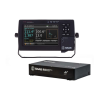
R5 SUPREME - Navigation System
OPERATION
7000 118-301, A Page 96
The GPS/DGPS Overview displays information related to the current navigation
solution:
Received Satellites
Number of received satellites from which signal is received.
Used Satellites
Number of GPS satellites currently used in the navigation solution.
RAIM Accuracy Limit
The currently used RAIM accuracy limit used in the RAIM calculations. See chapter 3
―Concepts and Terminology‖ for more information.
RAIM Status
The current RAIM status result which can be Safe, Unsafe or Caution. The RAIM status
is also indicated by RAIM LED on the front of the R5 SUPREME CDU. A green LED
corresponds to the safe state, yellow to caution state and red to unsafe state.
Correction Source
The currently used correction source for differential correction which can be Beacon,
SBAS, External or None (-).
Ref. Station ID
The reference identity of the currently applied differential corrections (if any).
Correction Age
The time difference between navigation solution and reference time for the applied
corrections (if any).
Beacon receiver tuning mode
Manual or Frequency Scan. Only displayed when correction source is Beacon.
DGPS warning
A warning that can be shown and which is related to an active DGPS Integrity Alert.
The warnings that can be displayed are:
No Signal. A correction source for GPS other than None has been selected
in the GPS Configuration view and more than ten seconds have passed
since new differential corrections were applied to the navigation solution.
Station Unhealthy. Correction source Beacon has been selected and the
radio beacon station in use indicates an unhealthy status.
Station Unmonitored. Correction source Beacon has been selected and the
radio beacon station in use indicates an unmonitored status.
Poor signal. Correction source Beacon has been selected and the word
error rate of the received signal in use exceeds 10%.
5.11.2 SBAS Info
The SBAS Information view shows information relating to the one or two geostationary
SBAS satellites that the R4 Navigation Sensor is receiving or expecting to receive
signals from. Identity (PRN number) and longitude of the satellite as well as elevation
and azimuth angle from the current position to the satellite and bit error rate of the
received signal is provided by the view. Additionally, when using SBAS as correction


 To Next Page