Do you have a question about the Simrad NSE8 and is the answer not in the manual?
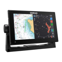
Details the physical layout, buttons, and indicators on the NSE unit's front panel for user interaction.
Explains the organization of the NSE display into page groups and individual panels for system navigation.
Covers interaction methods using menus, dialogs, and specific keys like MENU, PLOT, GOTO for system control.
Step-by-step guide for powering the NSE unit on, off, and placing it in standby mode.
Instructions on navigating menus using the rotary knob and confirming selections with keys.
How to activate, move, and use the cursor for selection and information display on screen.
Managing the display by selecting, switching, and maximizing different panels and pages.
How to activate the simulator for practicing unit operation and familiarization without external equipment.
Configuration options for simulator behavior, including source files and simulated GPS data.
Details the chart display features, vessel position relative to land, and overlay capabilities.
Explains cursor interaction for selecting objects, measuring distance, and panning the chart view.
Step-by-step process for plotting waypoints and defining navigation routes.
Defines waypoints, how to position them, and their purpose in navigation and route creation.
Covers the automatic recording and display of the vessel's historical path for retracing journeys.
Instructions for creating, editing, and saving navigation routes composed of multiple waypoints.
Overview of the radar display elements, including range rings, heading line, and data bar for target identification.
Explains how to control the radar scanner's operational states: Off, Standby, and Transmit.
Adjusting radar center, orientation, motion, and color for optimal target detection and viewing.
Explains the various symbols used to represent different types of targets detected by radar or AIS.
Configuration of alarms for vessel proximity, lost targets, and other critical events for collision avoidance.
Introduction to the echosounder display, showing water column and bottom structure for fish detection.
Options for configuring the echosounder display, including zoom, bottom lock, and split screen views.
Adjusting gain, auto gain, color, and noise rejection for improved echosounder readings.
Procedures for recording and saving echosounder data for later analysis and review.
How to navigate to and display the StructureScan data on the NSE unit via the ECHO DAK.
Describes the DownScan and SideScan image types provided by StructureScan for seabed detail.
Adjusting zoom, range, frequency, clarity, and color settings for StructureScan image optimization.
Explains the different steering modes and features available for the autopilot system.
How to place the autopilot in standby mode and use basic controls for manual steering.
How the autopilot facilitates navigation to waypoints or along routes using GPS data.
Utilizing wind data for autopilot steering, specifically for sailboats in WIND mode.
Initiating navigation towards a cursor position, waypoint, or along a predefined route.
Configuring essential navigation settings like arrival radius, off course limits, and datum.
Overview of the Steer and Position panels displaying critical navigation data like speed and coordinates.
Guide to modifying dashboard layouts and selecting data gauges for display on the instrument panel.
Instructions for connecting and operating Sirius satellite audio services via the NSE system.
Displaying weather information, such as SST and precipitation, as an overlay on the chart panel.
How to obtain and view marine weather forecasts for selected areas or current vessel position.
Setting up alarms for severe weather conditions to ensure timely alerts and safety.
Accessing the CZone system interface for controlling vessel power, monitoring parameters, and system overview.
Accessing lists of AIS, MARPA, and DSC vessels with their associated information.
Managing active alarms, reviewing alarm history, and configuring alarm settings for system monitoring.
Viewing and managing saved navigation data including waypoints, routes, and tracks.
Configuring page groups, adding/removing panels, and arranging display layouts for personalized views.
Modifying the dimensions of panels within multi-panel pages for optimized display and readability.
Adjusting system-wide parameters like language, text size, time, and screen capture for user interface customization.
Classification of alarm messages based on their color coding and associated importance level.
Detailed configuration of various alarm conditions and their notification behavior for proactive safety.
Connecting and displaying video feeds from optional cameras to the NSE system for monitoring.
Adjusting video source selection, mirroring, optimization, and standard for optimal camera input.
Recommendations for basic care and protection of the NSE unit to ensure longevity.
Steps for exporting and saving crucial system data like waypoints, routes, and settings for data safety.
An overview of the various system settings categories accessible through the main menu.
Explains how to access panel-specific and general context-sensitive menus for efficient operation.
| Display Size | 8 inches |
|---|---|
| Resolution | 800 x 480 pixels |
| Display Type | TFT LCD |
| Backlight | LED |
| Touchscreen | Yes |
| Power Supply | 12/24 V DC |
| Waterproof Rating | IPX7 |
| NMEA0183 Ports | 2 |
| NMEA2000 Connectivity | Yes |
| Operating Temperature | -15°C to +55°C |
| Weight | 3.1 lbs |
| Screen Size | 8.0 in |
| Screen Resolution | 800 x 600 |