21
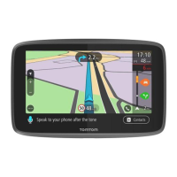
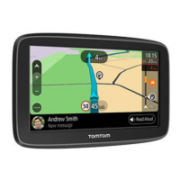
4. Route symbols. Symbols are used on your route to show your starting location, your stops, and
your destination.
5. Main Menu button. Select the button to show the Main Menu.
6. Speed panel. This panel shows the following information:
The speed limit at your location.
Your current speed. If you drive more than 5 km/h or 3 mph over the speed limit the speed
panel turns red. If you drive less than 5 km/h or 3 mph over the speed limit the speed panel
turns orange.
The name of the street you are driving on.
7. Current location. This symbol shows your current location. Select the symbol or the speed panel
to open the quick menu.
Note: If your GO cannot find your location the symbol appears grey.
8. Select the phone button in the map or guidance view to activate your phone and make
hands-free calls.
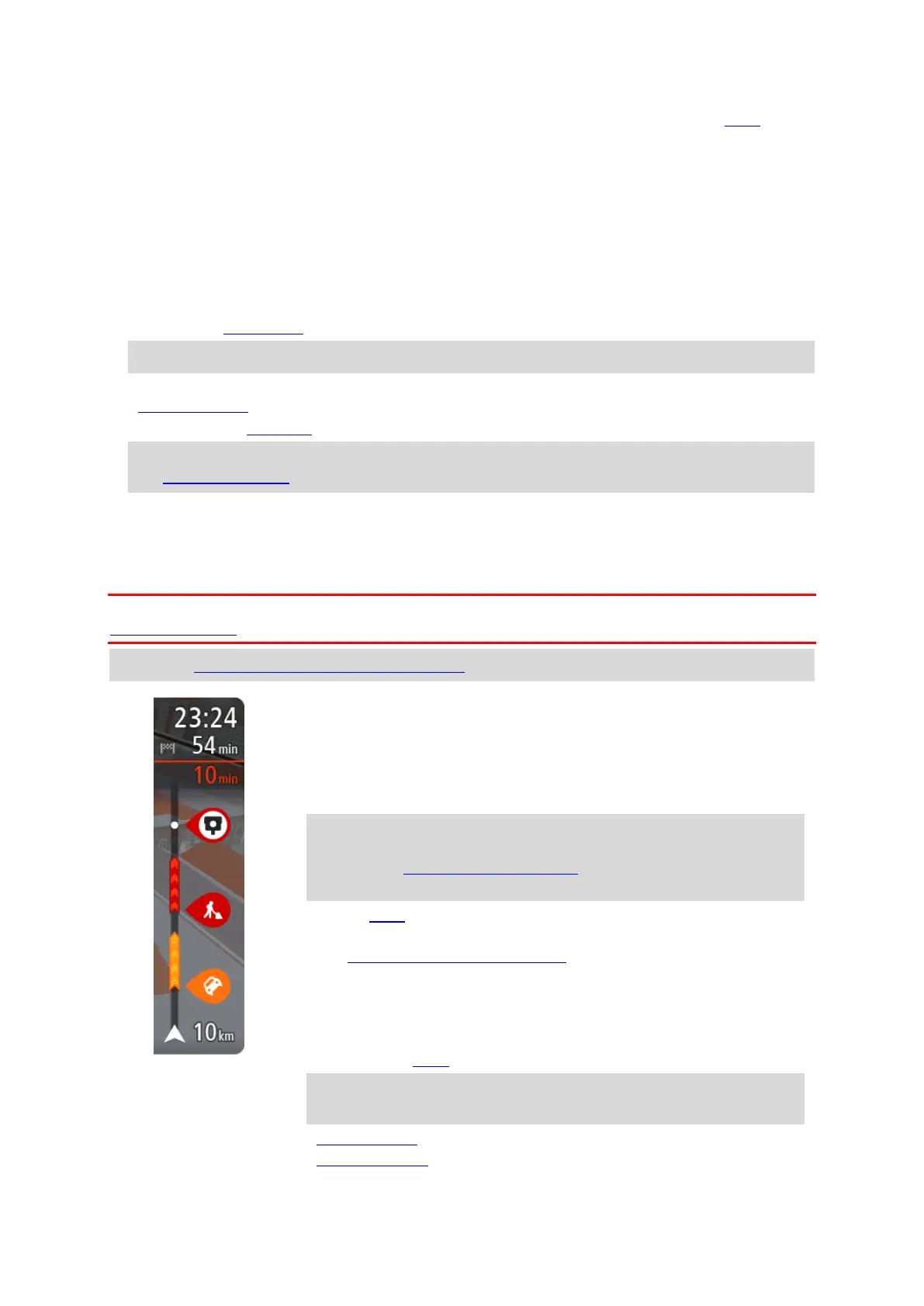
9. Route bar. The route bar is shown when you have planned a route.
Important: To see a wider route bar showing additional route information, change the setting
for Route Information.
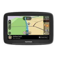
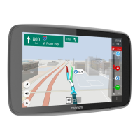
The route bar
The route bar is shown when you have planned a route. It has an arrival information panel at the
top, and a bar with symbols underneath.
Important: To see a wider route bar showing additional route information, change the setting for
Route Information.
Note: The distance ahead shown by the route bar depends on the overall length of your route.
The arrival information panel shows the following information:
The estimated time that you will arrive at your destination.
The length of time to drive to the destination from your current
location.
A parking button is shown near the destination flag when parking is
available near your destination.
Tip: If your destination is in a different time zone, you see a plus
(+) or a minus (-) sign and the time difference in hours and half
hours in the arrival information panel. The estimated time of arrival
is the local time at your destination.
If you have stops on your route, select this panel to change between
information about the next stop and your final destination.
You can choose the information you see on the arrival information panel.
Traffic status - if your GO isn't receiving any traffic information, a
symbol showing traffic with a cross appears underneath the arrival
information panel.
The bar uses symbols to show the following information:
The next two stops on your route.
Tip: To quickly remove a stop, select it in the route bar and use the
menu.
Petrol stations that are directly on your route.
TomTom Traffic including heavy rain or snow.

 Loading...