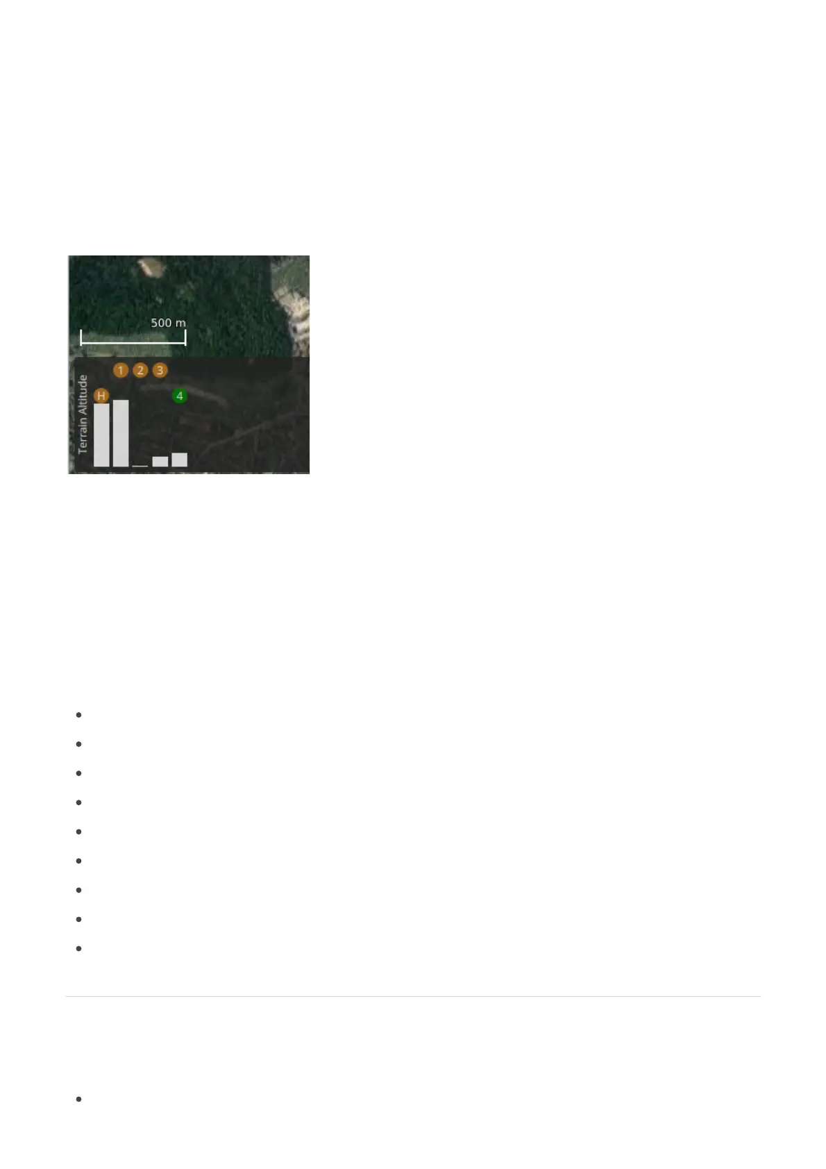
At the bottom of the map you will see a representation of the height differences between your mission
commands. The white bars below the mission items indicate the relative height above ground level. The
ground level is an estimation based on satellite surveys, these do not account for structures like buildings,
power lines or trees. A visual on-site inspection must always be performed. QGroundControl only accounts
for terrain altitudes directly below the planned waypoints, it does not account for terrain altitudes between
waypoints. The will verify terrain altitudes across the entire mission path.DeltaQuad Mission Validator
Mission conforms with local laws and regulations.
The mission was planned in accordance with the guidelines set forth in the .Plan section
The mission passed the DeltaQuad Mission Validator
Altitudes verified across terrain height.
The mission path is free of obstructions for at least 200 meters in each horizontal direction.
VTOL Takeoff and VTOL Land items correctly applied.
The takeoff location is free from obstructions at transition altitude for 500m in every direction.
Takeoff and land site is clear of obstacles and structures higher than transition altitude.
The path for takeoff and landing is set so that the vehicle points into the wind.
 Loading...