BRIEF OVERVIEW OF NAVIGATOR USE: POSITION 49
POSITION
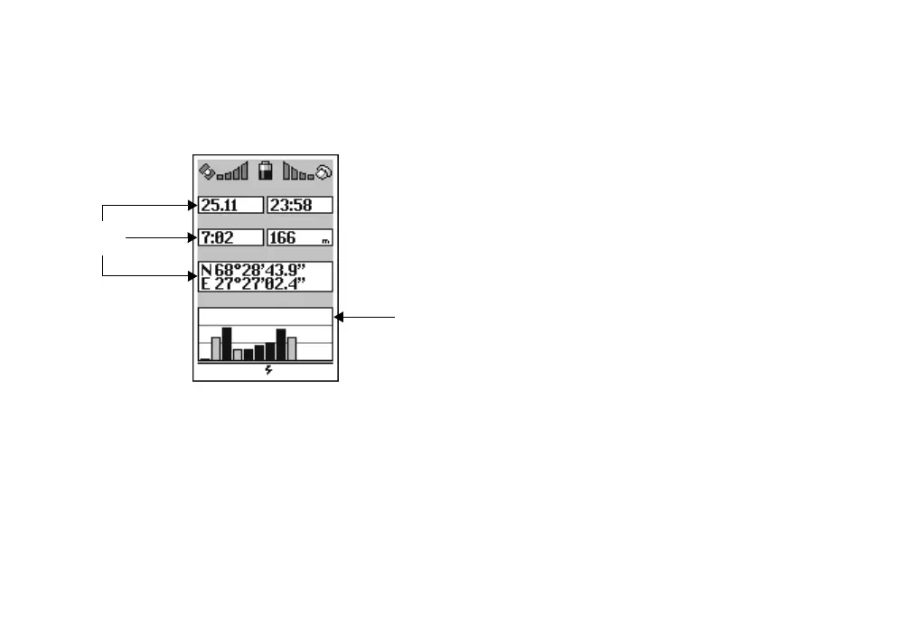
The Position page shows various data fields related
to your present position, time, and satellite status.
The data fields are constantly changing, and show
information such as date, time, sunrise, elevation
above sea level, coordinates, and satellite status.
The satellite status field can hold up to twelve bars;
one for each visible satellite. Bar height signifies
signal strength - the higher the bar, the stronger
the signal. Satellites with black bars are currently
used for navigation, while grey bars signify satel-
lites that are still being locked to.
Depending on currently used GPS operating mode,
the satellite status text buffer may also show, how
old the last found position is.
Some of the data on this page depends the GPS re-
ceiver’s ability to determine your position.
MENU GPS
Date
Satellite
status
Data
fields
Time
Dawn Elevation
Coordinates
Satellites