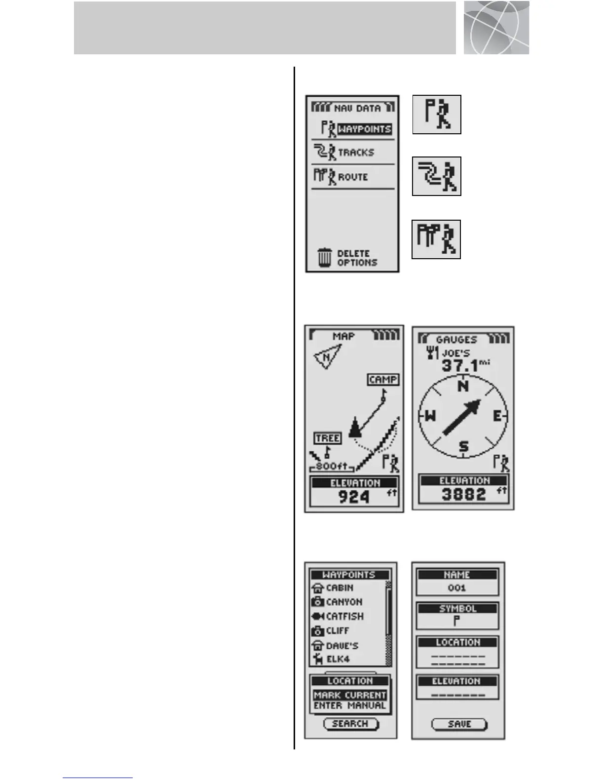
Navigating with Waypoints
The Nav Data page gives you access to
navigational features. From this page, you
can create and store up to 500 waypoints
(a specific location that you can mark and
recall), view the "GoTo" direction to any
waypoint , edit information about a
waypoint, delete a waypoint, preview a
waypoint on the map, or sort or search a
list of waypoints. For each waypoint, you
can choose a name and assign a symbol.
NOTE: Whenever navigation is in
progress, a "hiker" icon will appear at the
lower right hand corner of Map page and
Gauges page .
New Waypoint
Enter Manually
1. Highlight and select WAYPOINTS .
2. Highlight and select MANUAL .
3. Edit or accept the default name and
symbol. Enter the new waypoint's
location and elevation . (Elevation
does not need to be entered to save a
manual waypoint.)
4. Highlight and select SAVE .
Mark Current
1. Highlight and select WAYPOINTS .
2. Highlight and select MARK CURRENT .
3. Edit or accept the default name and
symbol .
4. Highlight and select SAVE .
Waypoint Shortcut: To mark a new
waypoint using your current location, press
and hold the ENTER button for 2 seconds.
A confirmation window will pop up.
3
WAYPOINTS
Nav Data Page
Hiker Icons
Go To
Waypoint
Navigate
Track
Navigate
Route
“GoTo” on
Map Page
“GoTo” on
Gauges Page
Add New
Waypoint
Waypoint
Info Screen

 Loading...