● Spinning propellers can be dangerous. Stay away from spinning propellers and motors. DO NOT start the motors in
confined spaces or where there are people nearby.
● Maintain control of the remote controller as long as the motors are running.
● DO NOT stop the motors mid-flight unless in an emergency situation where doing so will reduce the risk of damage or
injury.
● It is recommended to use Method 1 to stop the motors. When using Method 2 to stop the motors, the aircraft may roll
over if it is not completely grounded. Use Method 2 with caution.
●After landing, power off the aircraft before turning off the remote controller.
Starting Operations
After the operation area and obstacles have been measured and settings have been configured, the DJI Agras app uses
a built-in intelligent operation planning system to produce a flight route based on the user’s input. Users can invoke an
operation after planning a field. The aircraft will begin the operation automatically and follow the planned flight route.
In scenarios with complicated terrain, Phantom 4 RTK and DJI TERRA
TM
can be used to plan flight routes and import
routes to the DJI Agras app for operation. Refer to the Agras T30 User Manual for more information.
Field Planning
The DJI Agras app supports flight route planning by flying the aircraft to waypoints, obstacles, and calibration points or
by walking to these points carrying a remote controller, a remote controller with an RTK dongle, or an RTK device. The
following route has been planned by walking to the points with a remote controller that has a RTK dongle connected.
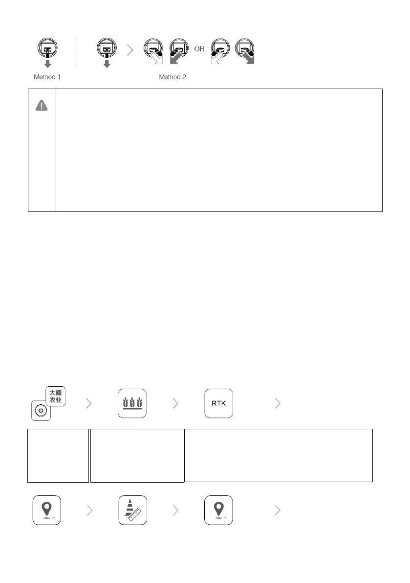
Before planning, make sure that the RTK high precision positioning module is mounted to the remote controller.
Power on the
remote
controller.
Launch DJI
Agras.
Tap Plan Field, select Walk
with RTK, and Walk with
RTK Dongle.
In RTK settings, select a method for receiving RTK signals
and configure the corresponding settings. Make sure the
aircraft status bar at the top of the screen is green.

 Loading...