AGRAS T50/T25
Unmanned Aircraft Flight Manual
48
©
2023 DJI All Rights Reserved.
Flight Modes
The aircraft will fly in N-mode (Normal) by default. Users can switch between flight modes by
toggling the Flight Mode switch on the remote controller when A-mode is enabled in the app.
N-mode/F-mode (Normal): The aircraft utilizes GNSS or the RTK module for positioning. When
the GNSS signal is strong, the aircraft uses GNSS for positioning. When the RTK module is
enabled and the differential data transmission is strong, it provides centimeter-level positioning.
It will revert to A-mode when the GNSS signal is weak or when the compass experiences
interference.
S-mode (mapped to A-mode, Attitude): GNSS is not used for positioning and the aircraft
can only maintain altitude using the barometer. The flight speed in A-mode depends on its
surroundings such as the wind speed.
Attitude Mode Warning
In A-mode, the aircraft cannot position itself and is easily affected by its surroundings, which
may result in horizontal shifting. Use the remote controller to position the aircraft.
Maneuvering the aircraft in A-mode can be difficult. Avoid flying in confined spaces or in areas
where the GNSS signal is weak. Otherwise, the aircraft will enter A-mode, leading to potential
flight risks. Land the aircraft in a safe place as soon as possible.
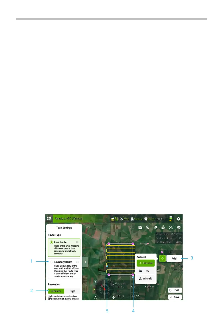
Mapping Operation Modes
After the boundary points of the task area have been added, the app will automatically produce
a task route. The aircraft will perform the mapping operation along the route and take photos
for the mapping task area. The app will reconstruct an HD map using the photos after the flight
so that users can plan a field on the HD map.
Operation Procedure
The instructions below use Route Mapping as an example. In Operation View, tap the mode switch
button on the upper left and select Route Mapping, then tap Add on the right of the screen.
1
2
3
45

 Loading...