TAWS display
TAWS display information
TAWS provides a map view, which is presented on the ND. Horizontal range selection is
controlled through the weather radar control panel.
The following illustrations identify the color banding on the ND.
NOTE: The yellow (ROC) band is not displayed on the ground or within one-tenth
nautical mile of the airport during the approach.
• Red indicates terrain above the aircraft.
• Yellow indicates terrain below the aircraft and penetrating the ROC.
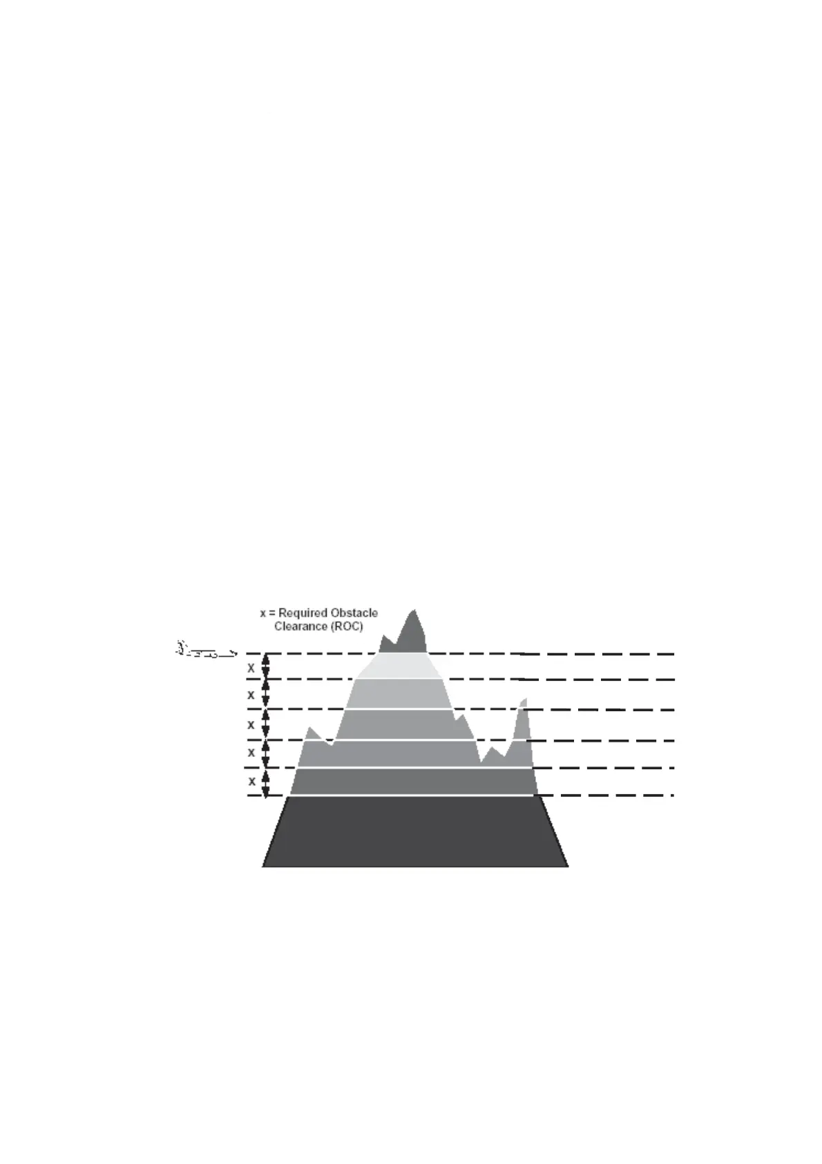
• Green indicates terrain below aircraft altitude minus ROC. The texture of the green
changes to show height contouring over a range of up to four ROC bands. When the
airplane is more than ROC band height above all terrain, terrain will be shown with the
highest terrain in green and lower terrain contoured up to three additional bands. (See the
following illustrations.)
• Black indicates terrain or water that is more than five ROC bands below the airplane
altitude. Water that is below the airplane altitude and within the ROC band height is
shaded yellow.
• Blue indicates areas of water, although water may be displayed as yellow depending on
the ROC of the aircraft.
• Magenta indicates areas where terrain database is not available.
Depiction of color banding within ROC band height
RED
YELLOW
GREEN 1
GREEN 2
GREEN 3
GREEN 4
BLACK
Fokker 50 - Flight Navigation Instruments