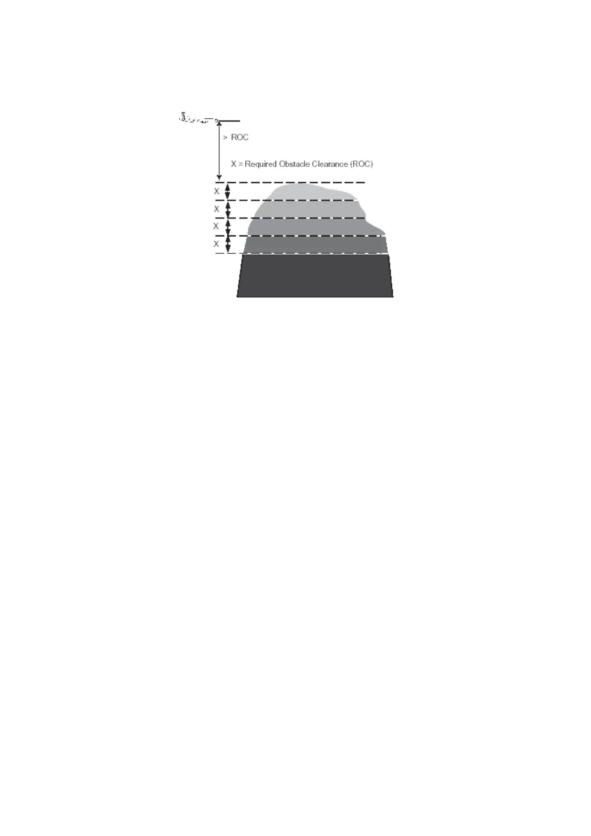
Depiction of color banding above ROC band height
TAWS will display a text overlay to assist in the identification of the displayed information.
The Map View has a Terrain Elevation text field on the left side of the map. The figures
indicate the highest terrain in their respective colors as depicted by the terrain displayed on
the map.
The top altitude shown represents the highest elevation in the red terrain. The bottom altitude
represents the highest elevation in the green terrain. The bottom indication will be blank if the
top indication is green.
The resolution of the elevations is in hundreds of feet, for example, 5,100 feet MSL will be
displayed as 051.
The WXR indicator displays a TERR mode annunciation on the right side of the map display.
The color of the TERR annunciation indicates the following status of TAWS:
• TERR in red indicates a TAWS warning level alert.
• TERR in yellow indicates a TAWS caution alert level.
• TERR in green indicates normal operation and no active alerts.
• TERR in magenta indicates a TAWS terrain fail condition.
The altitude and mode annunciation boxes can be displayed at different points on the TAWS
display to allow an unobstructed view of non-TAWS data on the indicator.
Fokker 50 - Flight Navigation Instruments