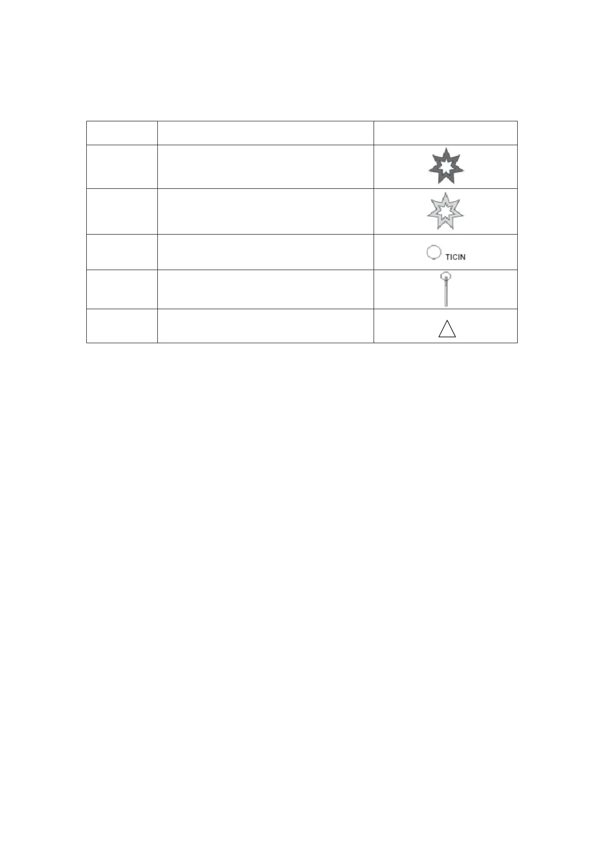
TAWS graphical symbols
Name Description
Symbol
Terrain
Threat
Warning
Two-dimensional hollow, seven pointed star.
Red with bold black border.
Terrain
Threat
Caution
Two-dimensional hollow, seven pointed star.
Yellow with bold black border.
Waypoint
IDENT
Text – Same color as associated waypoint.
White for down path legs, gray for waypoints
hidden behind terrain.
Waypoint
Post
Pole drawn from Waypoint elevation to
terrain elevation. Top 1000 feet is black with
remainder white.
Airplane
Symbol
Map View
Terrain threat
A terrain threat is depicted by a Terrain Threat Symbol. The characteristics of the symbol are
consistent with the alert level. When the FMS flight plan criteria has been met and the TAWS
computer calculates a predicted terrain threat along the flight plan, one of the two threat
symbols is displayed. If the alert level is CAUTION, the terrain alert symbol indication will be
a yellow star. This yellow star is issued approximately 60 seconds prior to the terrain threat. If
the alert level is WARNING, the terrain alert symbol indication will be a red star. This red
symbol is issued approximately 30 seconds prior to the terrain threat.
WARNING:
During high rates of descent or while turning near terrain caution and
warnings can occur in significantly less time than the normal 60 and 30
seconds prior to the threat.
Flight plan
When selected the FMS flight plan is overlaid on the navigation display(s). The overlay
graphically indicates current aircraft position as well as waypoint locations and idents for the
TO leg and beyond legs as selected. The legs follow standard map display concepts.
Connecting waypoints is done with a white line between waypoints. The TO leg is the color
magenta and subsequent legs are white. A valid flight plan must have more than 1 waypoint
to be displayed on TAWS.
The user can select which waypoint names to display using one of the following options
selectable through the FMS CDU:
• TO – display to waypoint only.
• ALL – display all waypoints.
• NONE – display no waypoints.
Fokker 50 - Flight Navigation Instruments