Do you have a question about the Garmin Alpha 100 T5 and is the answer not in the manual?
Steps to set up the Alpha system, including battery and charging.
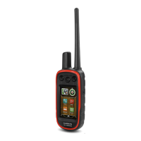
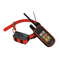
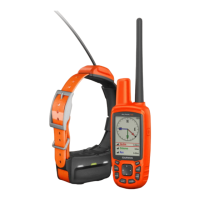
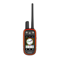
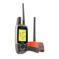
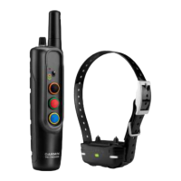
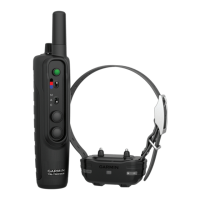
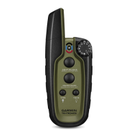
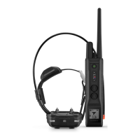
Description of the Alpha 100 Handheld Device and Dog Collar Device components.
Guide to installing batteries and charging handheld and collar devices.
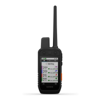
How to power devices, acquire satellites, and use the touchscreen interface.
Methods to add a dog collar: MURS/VHF, wireless pairing, and track/train codes.
Procedures for editing dog name, track color, type, and ID.
Resetting dog statistics and changing track display length.
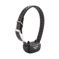
Enabling bark detection, sleep modes, and fitting the collar on your dog.
Viewing dog locations on map and using the compass tracker.
Navigating to your dog and temporarily pausing tracking sessions.
Setting up alerts for dogs entering or exiting specific locations.
How to edit or delete existing location alerts.
Understanding training methods and assigning functions to training keys.
Adding contacts via radio or ID, and sending emergency alerts.
Sending messages and viewing contact locations on the map.
Finding, changing, and updating contact IDs for interference avoidance.
Marking truck/covey, controlling collar light/rescue mode.
Recording, marking, editing, and deleting waypoints.
Repositioning, moving, increasing accuracy, projecting, and deleting waypoints.
Creating, editing, navigating, reversing, and deleting routes.
Enabling track logs, setting recording methods, and intervals.
Clearing, deleting, archiving tracks, and wireless data transfer.
Using the map display, measuring distance, and compass features.
Calibrating the compass and using bearing/course pointers.
Using "Where To?", finding waypoints, and Sight 'N Go navigation.
Viewing elevation data, calibrating altimeter, and using trip computer.
Setting proximity alarms and calculating the size of an area.
Using calendar, alarms, stopwatch, satellite data, and GPS settings.
Using the device to control VIRB action cameras.
Personalizing the main menu and data fields displayed.
Configuring general system parameters and specific dog settings.
Adjusting dog/contact track display and map zoom.
Customizing screen timeout, capture, appearance, and tones.
Configuring map display, orientation, and related features.
Fine-tuning map zoom, detail, and track recording methods.
Configuring routing preferences and changing units of measure.
Configuring time, position format, heading, and altimeter settings.
Accessing device info, software updates, and Garmin Express setup.
Important notices and instructions for device care and cleaning.
Procedures for replacing batteries and vehicle cable fuse.
Explanations of various data fields available on the device.
Information on buying accessories, maps, ANT+ sensors, and pairing tips.
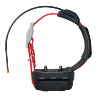
Identifying T5 components and removing the old battery.
Installing new T5 battery, replacing collar strap, VHF antenna, and fuse.
Comprehensive definitions for all available data fields on the device.
| Display resolution | 240 x 400 pixels |
|---|---|
| Display type | Color TFT |
| Battery type | Rechargeable lithium-ion |
| Battery life | Up to 20 hours |
| Water rating | IPX7 |
| High-sensitivity receiver | Yes |
| Interface | USB |
| Preloaded maps | Yes |
| Ability to add maps | Yes |
| Basecamp compatible | Yes |
| Waypoints/favorites/locations | 2000 |
| Track log | 10, 000 points, 200 saved tracks |
| Outdoor GPS games | Yes |
| Area calculation | Yes |
| Custom POIs | Yes |
| Sun and moon information | Yes |
| Picture viewer | No |
| Dog tracking | Yes |
| T 5 battery type | Rechargeable lithium-ion |
| T 5 water rating | IPX7 |
| GPS | Yes |
| GLONASS | Yes |
| Training Features | Yes |
| Waypoints | 2000 |
| Display size | 3" (7.6 cm) diagonal |
| T 5 battery life | Up to 40 hours |
| T 5 range | Up to 9 miles |
| T 5 GPS/GLONASS | Yes |
| Connectivity | ANT+ |
| Tracks | 10, 000 points |