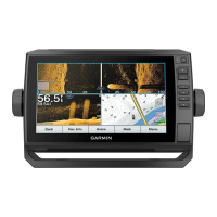
PGN Description
127489 Engine parameters: Dynamic
127493 Transmission parameters: Dynamic
127498 Engine parameters: Static
127505 Fluid level
129038 AIS class A position report
129039 AIS class B position report
129040 AIS class B extended position report
129794 AIS class A static and voyage related data
129798 AIS SAR aircraft position report
128000 Nautical leeway angle
129802 AIS safety-related broadcast message
129808 DSC call information
130310 Environmental parameters
130311 Environmental parameters (obsolete)
130313 Humidity
130314 Actual pressure
130576 Small craft status
This data applies only to NMEA 2000-compatible products.
NMEA 0183 Information
Transmit
Sentence Description
GPAPB APB: Heading or track controller (autopilot) sentence "B"
GPBOD BOD: Bearing (origin to destination)
GPBWC BWC: Bearing and distance to waypoint
GPGGA GGA: Global positioning system fix data
GPGLL GLL: Geographic position (latitude and longitude)
GPGSA GSA: GNSS DOP and active satellites
GPGSV GSV: GNSS satellites in view
GPRMB RMB: Recommended minimum navigation information
GPRMC RMC: Recommended minimum specific GNSS data
GPRTE RTE: Routes
GPVTG VTG: Course over ground and ground speed
GPWPL WPL: Waypoint location
GPXTE XTE: Cross track error
PGRME E: Estimated error
PGRMM M: Map datum
PGRMZ Z: Altitude
SDDBT DBT: Depth below transducer
SDDPT DPT: Depth
SDMTW MTW: Water temperature
SDVHW VHW: Water speed and heading
Receive
Sentence Description
DPT Depth
DBT Depth below transducer
MTW Water temperature
VHW Water speed and heading
WPL Waypoint location
DSC Digital selective calling information
DSE Expanded digital selective calling
HDG Heading, deviation, and variation
HDM Heading, magnetic
MWD Wind direction and speed
MDA Meteorological composite
Sentence Description
MWV Wind speed and angle
VDM AIS VHF data-link message
You can purchase complete information about National Marine
Electronics Association (NMEA) format and sentences from:
NMEA, Seven Riggs Avenue, Severna Park, MD 21146 USA
(www.nmea.org)
物質宣言
部件名称 有毒有害物质或元素
铅 汞 镉 六价铬 多溴联苯 多溴二苯醚
印刷电路板组件 X O O O O O
屏幕/背光 X O O O O O
金属零件 X O O O O O
电缆 电缆组件 连接器 X O O O O O
本表格依据 SJ/T11364 的规定编制。
O: 代表此种部件的所有均质材料中所含的该种有害物质均低于
(GB/T26572) 规定的限量
X: 代表此种部件所用的均质材料中, 至少有一类材料其所含的有害
物质高于
(GB/T26572) 规定的限量
*該產品說明書應提供在環保使用期限和特殊標記的部分詳細講解
產品的擔保使用條件。
產
品
© 2019 Garmin Ltd. or its subsidiaries
Garmin
®
, the Garmin logo, and ECHOMAP
™
are trademarks of Garmin Ltd. or its
subsidiaries, registered in the USA and other countries. These trademarks may not be
used without the express permission of Garmin.
NMEA
®
, NMEA 2000
®
, and the NMEA 2000 logo are registered trademarks of the
National Marine Electronics Association.
microSD
®
and the microSD logo are trademarks
of SD-3C, LLC.
© 2019 Garmin Ltd. or its subsidiaries
support.garmin.com
 Loading...