Do you have a question about the Garmin GHC 50 and is the answer not in the manual?
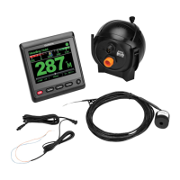
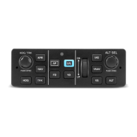
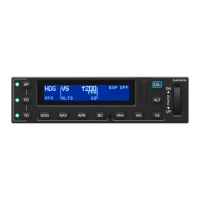
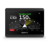
Displays status of the autopilot, including heading, speed, and mode.
Autopilot is inactive; user is responsible for helm control.
Takes control of the helm to maintain heading; indicators turn green.
Stops autopilot control; requires manual steering; indicators turn gray.
Maintains current heading without manual steering of helm or rudder.
Adjusts the desired heading using helm control or Shadow Drive technology.
Autopilot steers in preset patterns for fishing and maneuvers like U-turns.
Turns the boat 180 degrees and maintains the new heading.
Steers boat in a continuous circle at specified direction and time.
Steers boat port to starboard and back over specified time and angle.
Steers boat to run alongside initiation location, useful for man overboard.
Steers boat in a continuous circle around an active waypoint.
Steers boat to repeatedly pass over an active waypoint in a cloverleaf pattern.
Steers boat in increasingly larger circles outward from waypoint, forming a spiral.
Physically steer boat or select Standby to cancel a steering pattern.
Maintains specific bearing relative to apparent or true wind angle.
Engages wind hold after connecting a compatible NMEA 2000 wind sensor.
Switches wind hold type between apparent and true wind.
Transitions from heading hold to apparent or true wind hold.
Adjusts the wind hold angle in 1° or 10° increments.
Sets autopilot to perform tack or gybe maneuvers while in heading or wind hold.
Performs tack/gybe maneuvers when the autopilot is in heading hold.
Performs tack/gybe maneuvers when the autopilot is in wind hold.
Allows delaying steering a tack after initiating the maneuver.
Prevents the autopilot from performing a gybe maneuver.
Adjusts the default angle for tack maneuvers.
Adjusts autopilot responsiveness for varying sea and wind conditions.
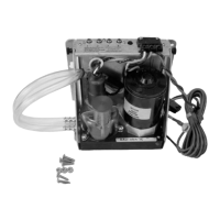
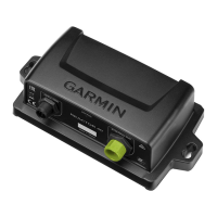
System setup requires a qualified installer; configuration via chartplotter.
Adjusts the increment size for step steering turns.
Selects the preferred source for heading data, e.g., internal compass or GPS.
Disables feature that allows manual helm movement to disengage autopilot.
Adjusts sensitivity for manual helm activity to disengage autopilot.
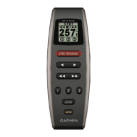
Wirelessly connects a compatible remote control to the chartplotter for autopilot control.
Customizes patterns or actions assigned to the remote control's buttons.
Allows control of the Garmin autopilot via a compatible Garmin watch.
Adjusts display/audio settings, GPS info, system info, power options, and simulator.
Configures beeper, backlight, color mode, and startup image.
Sets up to three autopilot actions for a Garmin watch.
Views autopilot system diagnostics report for configuration and troubleshooting.
Configures GPS, GLONASS, WAAS/EGNOS, Galileo, speed filter, and data source.
Displays software version and unit ID for updates or troubleshooting.
Shows a list of system events for monitoring and diagnostics.
Accesses electronic label for regulatory and compliance identification numbers.
Sets units of measure, language, filters, and keyboard layout.
Configures NMEA 2000 network devices, labels, and sensor naming.
Sets up, connects to, and changes channel for the device's Wi-Fi network.
Shares data with compatible Garmin peripheral devices and chartplotters.
Sets audible alarms for unit voltage and GPS accuracy.
Enables/disables alerts for the NMEA 2000 network and connected devices.
Instructions for updating device software using a memory card or chartplotter.
| Display Type | Color LCD |
|---|---|
| Display Resolution | 800 x 480 pixels |
| Power Supply | 10-35 Vdc |
| Water Resistance | IPX7 |
| Garmin Marine Network ports | 2 |
| Display Size | 5" |
| Weight | 0.68 kg |
| Operating Temperature | -15 to 70 °C |
| Compatible Networks | NMEA 2000 |