Do you have a question about the Garmin GPSMAP 86 Series and is the answer not in the manual?
Protects the chartplotter screen when not in use.
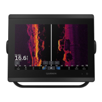
Identifies the main components of the chartplotter device.
Explains basic interaction methods for the touchscreen interface.
Details the function of various on-screen buttons displayed on the device.
Describes how to lock the touchscreen to prevent accidental touches.
Illustrates and lists the various ports and connectors on the chartplotter models.
Provides helpful tips and shortcuts for operating the chartplotter.
Explains how to access device manuals and Garmin support resources.
Explains how to use voice commands to operate the chartplotter.
Guides users on connecting a wireless headset to the chartplotter.
Lists available voice commands for controlling the chartplotter.
Covers pairing and using the GRID remote control with the chartplotter.
Provides steps to connect a mobile device to the GPSMAP device using the app.
Guides on enabling and receiving notifications from a mobile device on the chartplotter.
Covers accessing, dismissing, and managing received notifications.
Explains how to download and install software updates using the ActiveCaptain app.
Describes how to download and transfer chart updates via the ActiveCaptain app.
Guides on setting up a Wi-Fi network on the chartplotter for device connections.
Provides steps for connecting wireless devices to the chartplotter's Wi-Fi network.
Covers pairing and managing wireless remote controls.
Describes connecting Garmin wearables to view boat data.
Describes available chart views like Nav, Fishing, Perspective 3D, and Fish Eye 3D.
Differentiates Nav and Fishing charts and explains their uses.
Details how to zoom in/out and pan on charts using the touchscreen.
Covers measuring distance, creating waypoints, and viewing location info on charts.
Covers setting courses and navigating to destinations using various methods.
Describes various premium chart options and their features.
Provides information on viewing tide station data and animated indicators.
Covers overlaying satellite images and viewing aerial photos of landmarks.
Explains how AIS works for identifying and tracking other vessels.
Explains how to set up collision alarms for enhanced situational awareness.
Introduces the feature for creating custom contour maps with depth labels.
Guides users on mapping bodies of water using the Quickdraw Contours feature.
Describes the community for downloading and sharing user-created maps.
Addresses common navigation questions and route color coding.
Covers searching for and selecting destinations using charts or lists.
Guides on setting and following a direct course using Go To.
Explains how to stop an active navigation course or route.
Covers recording, managing, and navigating to waypoints.
Covers creating, saving, editing, and navigating routes.
Explains how Auto Guidance plots the best path, avoiding obstacles and hazards.
Covers using the device to optimize crossing the start line during races.
Explains how to display and configure laylines for racing.
Covers importing and using polar table data for optimal laylines and guidance.
Describes different sonar views available for fishfinding.
Covers transducer setup, appearance, and general sonar settings.
Discusses how transducer frequencies adapt sonar for specific goals and depths.
Configures how radar information is displayed over charts.
Ensures radar data aligns correctly with chart data based on boat heading.
Guides on transmitting radar signals and understanding standby mode.
Sets up zones to alert when anything enters a specified area around the boat.
Explains Mini-Automatic Radar Plotting Aid for target tracking and collision avoidance.
Enables tracking vessel movement on the radar display with faint trails.
Covers manual adjustment of radar gain for optimal performance and interference reduction.
Details settings for sea clutter, rain clutter, and scan averaging to reduce noise.
Covers radar options menu, setup, appearance, and installation settings.
Covers system installation and boat configuration for autopilot functionality.
Explains the display elements and controls of the autopilot screen.
Describes preset steering patterns for fishing and maneuvers like U-turns.
Guides on wirelessly connecting the chartplotter to a Force trolling motor.
Details the control bar and status indicators for the trolling motor.
Covers calibration, anchor gain, navigation gain, and arrival mode settings.
Explains how chartplotter and VHF radio interact for DSC features.
Guides on enabling Digital Selective Calling on the chartplotter.
Describes the log of recent DSC calls and contacts.
Explains how the chartplotter alerts and displays incoming DSC distress calls.
Guides on navigating to a vessel that has sent a distress call.
Explains how to view engine and environmental data displayed as gauges.
Identifies icons indicating engine abnormalities and issues.
Covers adding, arranging, and changing data displayed in gauges.
Explains settings related to Yamaha engine data display and features.
Details how to view and interpret Mercury engine data on the chartplotter.
Covers setting fuel level alarms and synchronizing fuel data.
Explains how to view wind information from a connected wind sensor.
Outlines the necessary equipment and subscription for SiriusXM weather services.
Explains how weather data is broadcast and potential delays.
Describes how weather warnings and bulletins are indicated on the chart.
Explains how precipitation is displayed on the weather chart.
Details how storm cells and lightning strikes are represented on the weather chart.
Covers viewing city, marine, and hurricane forecasts.
Explains how to view surface conditions like winds, wave height, and period.
Guides on selecting the source for video feeds on the chartplotter.
Explains how to alternate between multiple video sources at set time intervals.
Covers connecting and using IP cameras and thermal cameras on the Garmin Marine Network.
Details options for controlling camera views, including IR blend and scan modes.
Covers setup options like input, mirror, standby, scan speed, and stabilization.
Explains how to link a camera to a specific video source.
Introduces the system providing a bird's-eye view using dedicated cameras.
Guides on changing which camera feed is displayed on the Surround View screen.
Explains how to switch to a full-screen view of individual camera feeds.
Covers adjusting the layout to show one or two feeds alongside the bird's-eye view.
Explains how to enable and adjust the visual bumper and distance marker for docking.
Covers display, GPS, system information, station, power, and simulator settings.
Details beeper, audio setup, backlight, color mode, startup image, and screen lock settings.
Covers adjusting audible alarms, alerts, and warnings over connected audio devices.
Provides information on GPS satellites, GLONASS, WAAS/EGNOS, Galileo, and speed filter.
Covers changing station defaults, GRID pairing, display order, autopilot, and resetting layouts.
Explains how to view device software version and system information.
Covers setting units of measure, language, and navigation preferences.
Details route labels, turn transition, speed sources, and Auto Guidance settings.
Explains how to reset device settings to factory defaults.
Covers importing, exporting, sharing, and managing user data like waypoints and routes.
Guides on transferring user data between memory cards and the chartplotter.
Explains how to update device maps using Garmin Express and a memory card.
Explains how apps help manage the chartplotter, charts, and software updates.
Provides instructions for installing the Garmin Express app on a computer.
Guides on registering the device using the Garmin Express application.
Explains updating built-in maps using Garmin Express and a memory card.
Covers updating device software using ActiveCaptain or Garmin Express.
Details the pinout for the NMEA 0183 with audio cable and its connections.
Provides solutions for common device issues like GPS signal loss and power problems.
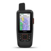
| Display Resolution | 240 x 400 pixels |
|---|---|
| Water Rating | IPX7 |
| High-sensitivity receiver | Yes |
| Ability to add maps | Yes |
| Garmin Connect™ compatible | Yes |
| Smart notifications | Yes |
| LiveTrack | Yes |
| Display Size | 3.0" (7.6 cm) diagonal |
| Display type | transflective, color TFT |
| Memory/History | 16 GB |
| Connectivity | NMEA 0183, NMEA 2000 |
| Waypoints/favorites/locations | 10, 000 |
| Routes | 250 routes |
| Wireless connectivity | Yes |
| Map segments | 15, 000 |
| inReach Features | Yes (on inReach models) |
| Sensors | Compass, Barometric altimeter |