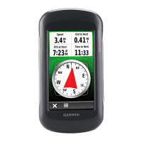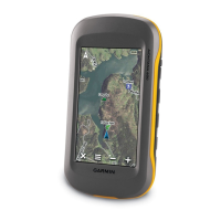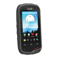
Do you have a question about the Garmin Montana 610 and is the answer not in the manual?
| Outdoor (hiking, trekking) | Yes |
|---|---|
| Marine (chartplotters, sounders) | No |
| Routes quantity | 200 |
| Number of waypoints | 4000 |
| Live Traffic Message Channel (TMC) | - |
| Map coverage | Switzerland |
| Display diagonal | 4 \ |
| Display resolution | - pixels |
| Internal storage capacity | 2.7 GB |
| Form factor | Fixed |
| Product color | Black |
| International Protection (IP) code | IPX7 |
| Power source type | Battery |
| Battery life (max) | 16 h |
| Depth | 36.4 mm |
|---|---|
| Width | 74.8 mm |
| Height | 144.2 mm |
| Weight | 289 g |
Details about the device's battery, including warnings and usage recommendations.
Guides the user through initial setup tasks for new device users.
Step-by-step instructions for installing the device's rechargeable battery pack.
Instructions on how to charge the device's battery pack via USB or wall outlet.
Instructions for installing alternative AA batteries for device power.
Instructions on how to power on the device.
Explains how to interact with the device using its touchscreen interface.
How to adjust screen brightness to conserve battery life or improve visibility.
Steps to acquire GPS signals and begin recording a track log.
How to mark and save the current location as a waypoint.
Method to mark a waypoint by selecting a location directly on the map.
How to locate and select saved waypoints from the waypoint manager.
How to modify the details of an existing waypoint.
Instructions for removing a waypoint from the device's memory.
Technique to improve waypoint accuracy by averaging multiple readings.
How to calculate a new location based on a known point's distance and bearing.
Information about recording, saving, and viewing track logs of your path.
How to start, pause, and manually control track recording.
Procedures for saving the entire current track or a portion of it.
How to choose between FIT, GPX, or both formats for saving track data.
Using recorded tracks to navigate back to the starting point.
Information about managing and storing past track logs.
Setting the device to automatically archive tracks based on schedule or capacity.
Core functions and modes for navigating to destinations.
Accessing the menu to find destinations, addresses, and points of interest.
Step-by-step guide to setting a destination and starting navigation.
Functionality to mark an emergency location and start immediate navigation back.
Using the map display to follow a route and view your progress.
Instructions for navigating street routes using automotive maps.
Using the device's compass to orient yourself and navigate towards a destination.
Steps to recalibrate the electronic compass for accurate directional readings.
Manual calibration process for the barometric altimeter.
Planning, saving, editing, and managing routes.
Step-by-step guide to planning and saving a new route.
Introduction to geocaching and finding hidden treasures using the device.
Steps to download geocache data from the internet to the device.
How to start navigation towards a selected geocache location.
How to record your findings (found, not found, needs repair) for a geocache.
Instructions for connecting ANT+ compatible accessories like heart rate monitors.
Personalizing device settings, menus, and data displays.
Configuring core device operations like GPS, language, and power key.
Instructions to recalibrate the compass for improved accuracy.
Configuring geocache list display, style, chirp searching, and filters.
Optimizing routes based on activity type, navigation voice, and route transitions.
Configuring settings related to fitness activities like laps and heart rate.
Options for resetting trip data, waypoints, tracks, or all settings.
How to reset all device settings to their original factory defaults.
Procedures for device care, software updates, and data management.
Steps to connect the device to a computer and update its software.
How to establish a connection between the device and a computer via USB.
How to reset the device if it becomes unresponsive, without data loss.
Solutions for common issues and questions about device operation.
Steps to perform a full factory reset of the device's settings.
Tips and solutions for improving battery life and addressing drainage issues.
Troubleshooting steps when the device is not recognized by the computer.
Solutions for issues with the device failing to acquire GPS satellite signals.
Troubleshooting steps when the device fails to charge its battery.
How to force the device into mass storage mode if it doesn't connect automatically.
How to reset the device if the touchscreen becomes unresponsive.
