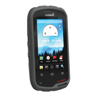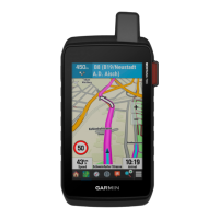
Do you have a question about the Garmin Montana 700i and is the answer not in the manual?
| Built-in camera | No |
|---|---|
| Text-to-speech message reader | - |
| Display diagonal | 5 \ |
| Display resolution | 480 x 800 pixels |
| Display size (HxV) | 108 x 64.8 mm |
| Display size (HxV) (imperial) | 4.25 x 2.55 \ |
| Battery type | Built-in |
| Power source type | Battery |
| Battery life (max) | 18 h |
| Form factor | Handheld |
| Product color | Black |
| International Protection (IP) code | IPX7 |
| Storage media type | Flash, Memory card |
| Compatible memory cards | MicroSD (TransFlash) |
| Maximum memory card size | 32 GB |
| Internal storage capacity | 16 GB |
| Tracks quantity | 250 |
| Number of waypoints | 10000 |
| Depth | 32.7 mm |
|---|---|
| Width | 91.9 mm |
| Height | 183 mm |
| Weight | 410 g |
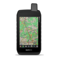
Detailed description of the Montana 700i/750i model's components and features.
Detailed description of the Montana 700 model's components and features.
Explains the device status LED and its color/flash patterns.
Instructions for installing the lithium-ion battery and charging the device.
How to use the power button to turn on/off, sleep, or open the status page.
Covers basic gestures, locking, and unlocking the device's touchscreen interface.
How to control screen brightness to conserve battery life.
Step-by-step guide to activating the device, including satellite subscription.
How to acquire satellite signals for GPS functionality and understanding the Iridium network.
Explains various icons displayed on the device's status bar for quick reference.
Sending, receiving, replying, and deleting text messages via the Iridium network.
Recording track points and transmitting them over the Iridium satellite network.
Initiating, customizing, canceling, and testing SOS rescues for emergencies.
Syncing inReach data and managing contact information for messages.
Using the map to view location, navigate, and explore details.
Customizing map display options, orientation, and measurement tools.
Configuring map display, zoom levels, detail, and text size for optimal viewing.
Adjusting how the map is displayed (North Up, Track Up, Automotive).
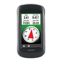
Using the compass to orient yourself and navigate towards a destination.
Customizing compass display and behavior, including Sight 'N Go.
Displays current speed, distance, and other trip statistics.
Displays elevation over distance traveled and related settings.
Connecting and using Bluetooth compatible sensors for data.
Extending device functionality with apps, data fields, and widgets.
Downloading high-resolution map imagery for the device.
Syncing waypoints, tracks, and routes with the Garmin Explore app.
Finding destinations using various categories and searching for locations.
Step-by-step guide to starting navigation to a selected destination.
Searching for destinations by street address using preloaded maps.
Guidance on navigating routes when City Navigator maps are installed.
Creating, navigating to, finding, editing, and deleting waypoints.
Refining waypoint location accuracy by averaging GPS readings.
Creating a new waypoint by projecting from a known location.
Adjusting a waypoint's position directly on the map interface.
Discovering points of interest near an existing waypoint.
Creating alerts for when you enter a specified radius around a waypoint.
Incorporating a waypoint as an intermediate point in an existing route.
Creating, saving, editing, and navigating routes between waypoints.
Following pre-planned routes stored on the device.
Inserting additional destinations or via points into an active route.
Displaying details of the currently active route and its waypoints.
Modifying an existing route by adding, removing, or reordering points.
Customizing how the device records activity data, including method and interval.
Accessing and reviewing the details of the currently active recorded activity.
Retracing your steps to navigate back to the start of an activity.
Procedures for saving the current recorded activity or a portion of it.
Displaying specific details of a recorded activity.
Generating a track from a recorded activity for sharing or navigation.
Following a previously recorded activity path for navigation.
Removing recorded activities from the device.
Receiving detailed weather forecasts and graphical maps via internet connection.
Requesting and receiving weather forecasts using the inReach subscription.
Steps to request basic, premium, or marine weather forecasts.
Refreshing expired or outdated inReach weather forecast data.
Accessing maps, routes, waypoints, and navigation features.
Recording activities, tracking paths, and viewing trip data.
Using messaging, SOS, and other safety-related inReach functions.
Using built-in tools like camera, compass, and calculators.
Features for geocaching, and predicted times for hunting and fishing.
Accessing messaging, weather, remote control, and utilities for inReach.
Functions for saving MOB locations and viewing the map.
Marking waypoints, managing messages, and viewing notifications.
Accessing recorded activities, controlling recording, and changing profiles.
Planning routes, viewing tracks, and using setup menus.
Sharing data wirelessly and using navigation assistance like Sight 'N Go.
Customizing camera, geocaching, sensor, and fitness settings.
Viewing sun/moon data, trip computer, and tracking functions.
Using VIRB remote, waypoint averaging, and XERO location features.
Displaying and customizing data fields and dashboards on various pages.
Showing custom data fields on the map page for quick access.
Selecting and configuring data fields for display on different pages.
Tailoring the information shown on dashboards for various pages.
Accessing and configuring system settings, display, and connectivity.
Adjusting system-wide preferences including satellite, language, and power.
Configuring screen brightness, timeout, orientation lock, and appearance.
Pairing devices, managing Bluetooth connections, and customizing phone settings.
Prolonging battery life by reducing GPS tracking frequency.
Customizing tones for messages, warnings, and alarms.
Adjusting photo resolution, storage, and viewing camera instructions.
Configuring geocache display, live data, and device registration.
Pairing ANT+ or Bluetooth sensors like heart rate monitors.
Customizing settings for fitness activities, including auto lap and user profiles.
Entering personal information to calculate accurate fitness and training data.
Configuring marine chart modes, appearance, and alarms.
Customizing the main menu, favorites bar, setup, and find menus.
Setting the geographical position format and datum for location readings.
Customizing units for distance, speed, elevation, temperature, and pressure.
Creating and managing custom profiles to optimize settings for different activities.
Customizing settings and data fields for a particular activity or trip.
Resetting trips, waypoints, activities, or all device settings to factory defaults.
Installing software and map updates for the device.
Connecting the device to a computer to use Garmin Express for updates.
Finding additional manuals, articles, and software updates online.
Accessing regulatory and compliance information electronically on the device.
Instructions for installing optional AA batteries for extended use.
Guidelines for cleaning, protecting, and maintaining the device.
Proper methods for cleaning the device exterior and touchscreen.
Understanding file types supported and managing device data.
Steps for installing a microSD card for additional storage or maps.
Instructions for connecting the device to a computer via USB for data transfer.
Procedures for transferring files between a computer and the device.
Guidelines for safely deleting files from the device's memory.
Connecting the device to Garmin Connect for data management and analysis.
Safely disconnecting the device from a computer to prevent data loss.
