Do you have a question about the Garmin Montana 700 Series and is the answer not in the manual?
| Display Resolution | 480 x 800 pixels |
|---|---|
| Water Rating | IPX7 |
| High-sensitivity Receiver | Yes |
| Barometric Altimeter | Yes |
| Camera | No |
| Smart Notifications | Yes |
| GPS | Yes |
| GLONASS | Yes |
| Galileo | Yes |
| Display Size | 5 inches |
| Battery Type | Rechargeable lithium-ion |
| Battery Life | Up to 18 hours |
| Memory/History | 16 GB |
| Preloaded Maps | Yes |
| Expandable Storage | microSD card slot |
| Interface | USB |
| Waypoints/Favorites/Locations | 10, 000 |
| Routes | 250 |
| Sensors | Compass, Barometric Altimeter |
| Compass | 3-axis |
| Geocaching-friendly | Yes |
| Outdoor Recreation Features | Area calculation, Hunt/fish calendar, Sun and moon information |
| Connectivity | Bluetooth, Wi-Fi, ANT+, USB |
| LiveTrack | Yes |
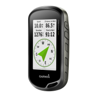
Overview of the physical layout of the Montana 700i/750i and 700 devices.
Explanation of the device's status LED and its meanings.
Step-by-step guide for installing the lithium-ion battery pack.
Method to charge the device faster using an AC adapter.
Guidelines for storing the device for extended periods.
Explains how to use the power button for various functions.
How to access and interpret the status page information.
Method to adjust screen brightness to save battery.
How to prevent accidental screen touches.
Explanation of how the Iridium network is used for device features.
Steps to acquire GPS satellite signals for device operation.
Explanation of various status icons displayed on the device.
How to send and receive text messages using the Iridium network.
Guide to sending pre-written messages.
Steps to compose and send custom text messages.
How to respond to incoming messages.
How the device checks for new messages.
How to view specific information about a message.
How to navigate to a location included in a message.
How to add location data to outgoing messages.
How to remove messages from the device.
Options to customize message alert behavior.
How to record and transmit track points.
Steps to begin tracking activity.
Steps to end tracking activity.
How to share your location with others via MapShare.
Settings for automatic tracking and interval adjustments.
How to start an emergency rescue request.
How to send a personalized message during an SOS.
How to abort an active SOS request.
How to verify the satellite subscription and device functionality.
How to sync data between the device and Garmin Explore app.
How to manage contacts for messages.
How the map displays location and navigation data.
Techniques for using the map for navigation.
How the compass works and its display.
Overview of the trip computer and its data.
Options for customizing the map display.
How to use the compass for navigation.
Steps to calibrate the electronic compass.
How to use the Where To? page to find destinations.
Step-by-step guide for navigating to a chosen destination.
How to search for and navigate to a specific address.
Overview of saving and managing waypoints.
How to mark and save the current position.
How to navigate to a saved waypoint.
Methods to search for saved waypoints.
Using averaging to improve waypoint location accuracy.
Core navigation element defining a path to a destination.
Steps to create a new route by adding points.
How to follow a previously created route.
How to modify an existing route.
Core activity tracking function recording path data.
Options for customizing activity recording.
How to save the recorded activity.
How to use TracBack to return to the start of an activity.
Navigation element defining a path with multiple destinations.
Steps to create a new course by adding points.
How to follow a previously created course.
Features for receiving weather information.
How to request weather forecasts via inReach.
How to add, remove, and reorder items in the main menu.
Access to device settings and customization options.
View and manage saved waypoints.
Create and manage routes for navigation.
Initiate an emergency SOS rescue.
Record and transmit track points via satellite.
Group related items into adventures for trips.
Transferring data between device and BaseCamp software.
How to set an audible alarm on the device.
How to take and view photos on the device.
How to view the location and status of connected dogs.
Overview of geocaching activity and its purpose.
How to register the device for geocaching services.
How to load geocaches onto the device via a computer.
How to search for geocaches on the device.
How to navigate to a selected geocache.
How to enable searching for chirp accessories.
How to save and navigate to a Man Overboard location.
Essential steps for downloading maps to the device.
How to activate installed map products on the device.
How to organize maps into sets for easier management.
How to modify existing map sets.
How to view GPS satellite status and signal strength.
How to configure GPS satellite system and display options.
How to display custom data and group it into dashboards.
How to modify data fields on various pages.
Configure system settings like language and power key.
Adjust backlight, orientation, and appearance for the screen.
Manage Bluetooth and Wi-Fi connections for features.
Customize map, routing, recording, and fitness settings.
Adjust satellite system options and WAAS/EGNOS.
Assign shortcuts to the power button for quick access.
Adjust backlight, orientation, and appearance.
Pair and manage smartphone connections and notifications.
Connect and manage wireless network configurations.
Core navigation setup for route calculation.
Customize settings for prolonging battery life in expedition mode.
Customize tones for alerts, warnings, and alarms.
Configuration for geocaching features.
How to pair and use wireless ANT+ or Bluetooth sensors.
Customize settings for recording fitness activities.
Customize display and alarms for marine navigation.
Customize the appearance of device menus and favorites bar.
Set geographic position format and map datum.
Select units for speed, distance, elevation, and temperature.
Create and customize activity profiles for different uses.
How to reset trip data, waypoints, or all device settings.
How to restore default page configurations.
How to install and use Garmin Express for updates and management.
How to install optional AA batteries for power.
Important notices and warnings for device maintenance.
How to clean the device exterior and touchscreen.
How to install a microSD card for storage.
Steps to connect the device via USB for data transfer.
How to copy files between computer and device.
Explains the meaning of various data fields displayed on the device.
Definitions for distance, speed, ascent, descent, and calories.
Definitions for compass heading, bearing, and distance to destination.
Definitions for current position, off-course distance, and ETA.
Tips to extend battery performance and longevity.
Essential steps to restart the device if it becomes unresponsive.
Steps to change the device language selection.
Table showing heart rate zones, exertion, and benefits.