Do you have a question about the Garmin Oregon 700 Series and is the answer not in the manual?
Provides a detailed look at the device's physical components, battery types, installation, and tips for maximizing battery life.
Covers turning on the device, enabling battery save mode, and installing AA or NiMH batteries.
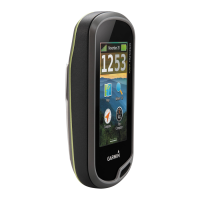
Details on charging the battery, powering on the device, and navigating the home screen.
Instructions for using the touchscreen, locking it, and acquiring satellite signals for navigation.
Overview of features that connect to smartphones or wireless networks for enhanced functionality.
How to add custom data fields, widgets, and apps via the Connect IQ store, using mobile app or computer.
Covers selecting, recording, saving, editing, and deleting activities and their associated data.
Registering, searching, navigating to, using hints for, and logging geocaches on the device.
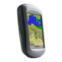
Covers basic navigation, TracBack, finding locations, compass use, calibration, and elevation plots.
Creating, finding, editing, deleting, increasing accuracy, and projecting waypoints; creating and managing routes.
Creating and managing adventures, grouping tracks/photos/geocaches, and sending files to BaseCamp.
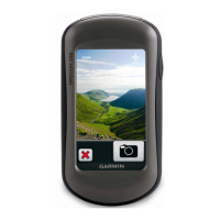
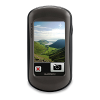
Using the camera, overview of applications like Weather, Calendar, and setting proximity alarms.
Setting alarms, countdown timers, stopwatch, and viewing weather conditions and forecasts.
Viewing satellite status, controlling GPS, and overview of fitness tracking history and Garmin Connect use.
Connecting ANT+ sensors, understanding heart rate zones, and customizing device keys.
Adjusting backlight, touchscreen sensitivity, screen rotation, and display settings.
Configuring map settings, customizing data fields, dashboards, and adding menu shortcuts.
Configuring system settings like satellite, appearance, tones, and interface modes.
Configuring routing preferences, including activity type, calculation method, and avoidance setup.
Customizing heading display, altimeter settings, position format, and units of measure.
Configuring time zone, geocaching options, and ANT+ sensor settings.
Configuring fitness settings like auto lap, activity types, user profiles, and heart rate zones.
Options to reset data, restore defaults, and guidelines for device care and cleaning.
Accessing device information, attaching the carabiner clip, and setting the home screen to classic mode.
Information on data management, file types, and installing a memory card.
Connecting to a computer, transferring files, and deleting files from the device.
Safely disconnecting the USB cable, troubleshooting device issues, and viewing device information.
Details on the device's technical specifications including battery, water rating, and operating conditions.
Information about the ANT+ wireless temperature sensor and definitions for various data fields.
Explanations for numerous data fields related to ascent, descent, speed, heart rate, and navigation.
Continued definitions for data fields and detailed explanation of heart rate zone calculations.
| Display Resolution | 240 x 400 pixels |
|---|---|
| Weight | 7.4 oz (209.8 g) with batteries |
| Battery Type | 2 AA batteries (not included); NiMH or Lithium recommended |
| Battery Life | Up to 16 hours |
| Water Rating | IPX7 |
| High-sensitivity Receiver | Yes |
| Waypoints/Favorites/Locations | 10, 000 |
| Routes | 250 |
| Track Log | 20, 000 points, 250 saved tracks |
| Ability to Add Maps | Yes |
| Basecamp Compatible | Yes |
| Automatic Routing | Yes (with optional mapping for detailed roads) |
| Geocaching-friendly | Yes (Paperless) |
| Custom Maps Compatible | Yes |
| Picture Viewer | Yes |
| Garmin Connect Compatible | Yes |
| GPS | Yes |
| Camera | No |
| Display Size | 3.0 inches |
| Interface | USB |
| Memory/History | 1.7 GB |
| Connectivity | Bluetooth, ANT+ |
| Sensors | Barometric altimeter, 3-axis compass |
| Memory | Expandable with microSD card (not included) |