Do you have a question about the Garmin Oregon 200 and is the answer not in the manual?
Learn how to properly install AA batteries into your Oregon device.
Guide to obtaining GPS signals for accurate location tracking and navigation.
Learn to navigate to a destination using the 'Where To?' menu or by selecting points on the map.
How to select a destination directly from the map display.
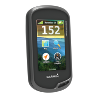
View current location, GPS accuracy, elevation, and satellite signal strength.
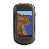
Explore the map, zoom, pan, and view location markers.
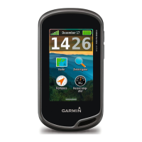
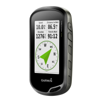
Use the compass to navigate, view speed, distance, and ETA.
Customize device settings by switching between or creating user profiles.
Create, store, and navigate custom routes.
Record, save, and view your traveled paths (tracks).
Configure GPS settings, language, battery type, and tones.
Configure map orientation, zoom levels, and data fields.
Manage user profiles, including renaming, reordering, deleting, and creating new ones.
Configure route calculation methods like Off Road and On Road options.
Configure compass display, north reference, and magnetic variation.
Step-by-step guide to manually calibrate the altimeter or barometer.
Information on GPS, DGPS, and velocity accuracy.
Steps to connect the Oregon to a computer using a USB cable.
Instructions for transferring data between the Oregon and a computer.
Tips and suggestions to maximize the battery performance and lifespan of your Oregon.
How to reset the Oregon device to its original factory settings.
| Outdoor (hiking, trekking) | Yes |
|---|---|
| Marine (chartplotters, sounders) | No |
| Routes quantity | 50 |
| Number of waypoints | 1000 |
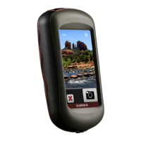
| Form factor | Handheld |
| Product color | Gray |
| Interface | USB |
| Number of tracklog points | 10000 |
| Display resolution | 240 x 400 pixels |
| Battery type | AA |
| Battery life (max) | 16 h |
| Number of batteries supported | 2 |
| Sustainability certificates | RoHS |
| Depth | 35 mm |
|---|---|
| Width | 58 mm |
| Height | 114 mm |
| Weight | 192.7 g |