Do you have a question about the Garmin Oregon 600t and is the answer not in the manual?
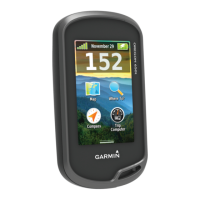
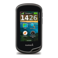
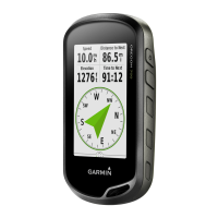
Details about the map display, waypoint selection, compass, and trip computer functions on the home screen.
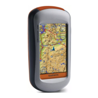
Instructions on selecting the appropriate map datum for different map types, like GDA94 or Aus Geod '66.
Procedure for reporting a location using grid references and descriptions for radio or general communication.
Steps to create a new waypoint by selecting coordinates and entering location details.
Instructions on marking your current position as a waypoint, with options to edit details.
Guide on how to select a waypoint from the manager and edit its information like coordinates.
Steps to select a waypoint and navigate to it using the map display or compass.
Method to improve waypoint location accuracy by averaging multiple readings.
How to adjust screen brightness and touchscreen sensitivity settings for optimal use.
Viewing detailed location and reception information for GPS satellites.
Instructions on how to reset the GPS device by removing and reinstalling batteries.
Information on the GPS' internal electronic compass functionality.
| Outdoor (hiking, trekking) | Yes |
|---|---|
| Marine (chartplotters, sounders) | No |
| Routes quantity | 200 |
| Number of waypoints | 4000 |
| Navigation protocols | NMEA 0183 |
| Form factor | Handheld |
| Product color | Black, Green, Grey |
| Map coverage | All Europe |
| Display diagonal | 3 \ |
| Display size (HxV) (imperial) | 2.5 x 1.5 \ |
| Storage media type | - |
| Compatible memory cards | MicroSD (TransFlash) |
| Internal storage capacity | 0.3 GB |
| USB 2.0 ports quantity | 1 |
| Supported radio bands | Not supported |
| Battery type | AA |
| Power source type | Battery |
| Battery life (max) | 16 h |
| Battery technology | Nickel-Metal Hydride (NiMH) |
| Number of batteries supported | 2 |
| Cables included | USB |
| Depth | 33 mm |
|---|---|
| Width | 61 mm |
| Height | 114 mm |
| Weight | 209.8 g |