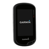
Do you have a question about the Garmin Oregon 650t and is the answer not in the manual?
| Outdoor (hiking, trekking) | Yes |
|---|---|
| Marine (chartplotters, sounders) | No |
| Routes quantity | 200 |
| Number of waypoints | 4000 |
| Navigation protocols | NMEA 0183 |
| Form factor | Handheld |
| Product color | Black, Grey, White |
| Map coverage | All Europe |
| Display diagonal | 3 \ |
| Display resolution | 240 x 400 pixels |
| Storage media type | - |
| Compatible memory cards | MicroSD (TransFlash) |
| Internal storage capacity | 4 GB |
| Megapixel | 8 MP |
| USB 2.0 ports quantity | 1 |
| Supported radio bands | Not supported |
| Battery type | AA |
| Power source type | Battery |
| Battery life (max) | 16 h |
| Battery technology | Nickel-Metal Hydride (NiMH) |
| Number of batteries supported | 2 |
| Cables included | USB |
| Depth | 33 mm |
|---|---|
| Width | 61 mm |
| Height | 114 mm |
| Weight | 209.8 g |
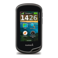
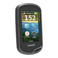
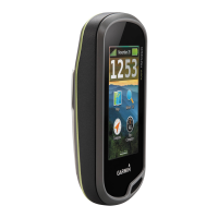
Overview of the Oregon 600 Series device hardware and key components.
Details on battery types, installation, charging, and maximizing battery life.
Instructions for installing NiMH or AA batteries.
Steps to power on the device and acquire satellite signals.
How to interact with the device using its touchscreen interface.
Creating, finding, editing, deleting, and projecting waypoints.
Using the menu to find destinations like addresses or points of interest.
Creating, editing, viewing, and deleting navigation routes.
Recording, customizing, and navigating using track logs.
Using a recorded track to navigate back to the starting point.
Saving, viewing, changing color, and archiving track data.
Creating and managing adventures to share experiences.
Bundling tracks, photos, and geocaches into an adventure.
Starting navigation, stopping, and using map guidance.
Starting navigation to a selected point or destination.
Using compass, Sight 'N Go, and driving routes for navigation.
Viewing elevation profiles and calibrating the altimeter.
Displaying and resetting trip statistics like speed and distance.
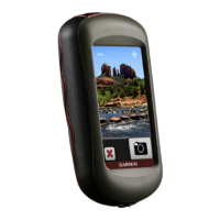
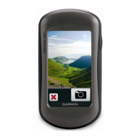
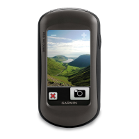
Taking photos and managing them on the device.
Capturing images with the device's camera.
Viewing, sorting, and setting photos as wallpaper.
Finding, downloading, and managing geocaches.
Transferring geocache data from a computer to the device.
Filtering lists and navigating to geocaches.
Information about the chirp accessory for geocaching.
Activating the device's search function for chirp accessories.
Setting up and tracking running, cycling, and other fitness activities.
Managing activity history and uploading to Garmin Connect.
Using ANT+ sensors like heart rate monitors and cadence sensors.
Connecting ANT+ sensors to the device.
Understanding heart rate zones for training and fitness improvement.
Configuring personal heart rate zones based on fitness profile.
Using built-in applications like 3D View, Calculator, and Alarms.
Viewing maps and terrain in a three-dimensional perspective.
Sharing data between devices using Bluetooth or ANT+.
Creating alerts for approaching specific locations.
Activating and adjusting the device's flashlight.
Measuring areas and using the device's calculator.
Using calendar, almanac, and alarm features.
Using the stopwatch and countdown timer features.
Viewing GPS satellite status and signal strength.
Adjusting satellite display and turning GPS off.
Personalizing device settings and appearance.
Adjusting backlight and customizing the main menu layout.
Locking touchscreen and screen orientation.
Setting up custom shortcuts for quick access.
Configuring data displayed on various device pages.
Activating data fields to be displayed on the map page.
Selecting and configuring data fields and dashboard layouts.
Selecting, creating, editing, and deleting device profiles.
Switching between pre-configured or custom device profiles.
Tailoring settings and data fields for a specific activity.
Assigning key shortcuts and configuring system-wide settings.
Configuring satellite system, language, interface, and battery type.
Adjusting screen timeout, orientation, capture, and appearance.
Enabling a mode to conserve battery power.
Enabling on-screen controls for scrolling lists.
Adjusting touchscreen sensitivity and device alert tones.
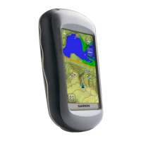
Configuring map display options like orientation, detail, and speed.
Configuring track recording methods, intervals, and auto-archive.
Setting track recording parameters and file format.
Optimizing routes based on activity type and road preferences.
Customizing compass display and altimeter calibration.
Ensuring accurate compass readings through calibration.
Manually calibrating the altimeter using known elevation.
Setting the coordinate format and map datum.
Customizing units, time zone, and camera options.
Configuring geocache display, search, and filter options.
Setting up filters and enabling chirp accessory search.
Managing ANT+ sensors and configuring fitness activity settings.
Entering personal data for accurate fitness tracking.
Using Auto Lap to mark laps based on distance.
Configuring marine chart modes and alarms.
Configuring alarms for marine navigation safety.
Options for resetting data, specific settings, or all default settings.
Accessing details about the device hardware and software.
Details on battery types, charging, saving modes, and extending life.
Guidelines for cleaning the device and understanding its water resistance.
Technical specifications of the Oregon 600 Series device.
Managing files and data on the device.
Instructions for installing a microSD card for storage or maps.
Steps for connecting the device to a computer via USB.
Copying files to/from the device and safely deleting files.
Properly disconnecting the device from a computer to prevent data loss.
Resolving common issues, updating software, and resetting the device.
Viewing device details and updating firmware.
Resetting the device and information on registration.
Additional information, clips, and optional maps.
Attaching accessories and using additional map products.
Details about the ANT+ wireless temperature sensor.
Detailed explanations of various data fields available on the device.
Further explanations of data fields like speed, time, and elevation.
Table detailing heart rate zones, perceived exertion, and benefits.