Geometrics Inc. G-882 Cesium Marine Magnetometer Page 32
You can use the INCLINATION map (see figure 35) to estimate the proper
orientation angle anywhere in the world as described below A TOTAL
INTENSITY map is also provided to enable determination of the expected range
of readings for the survey area (see figure 36).
Since the G−882 has “automatic hemisphere switching”, reversing direction is
automatically handled and identical sensor positions are required for operation in
the Northern or Southern hemispheres. Thus there are three regions in either
hemisphere that are of interest with regards to positioning the G−882 cesium
sensor. These regions have dip angles or magnetic field inclination angles of 0 -
22.5, 22.5 - 67.5 and 67.5 - 90 in either hemisphere.
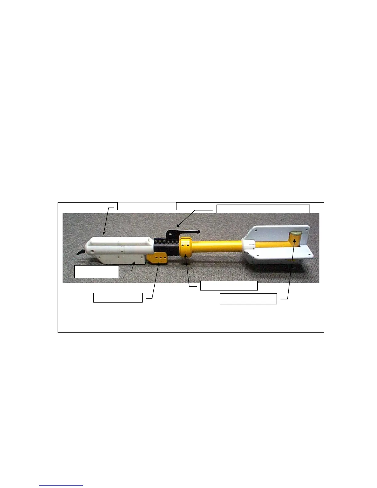
Assembling the G−882 as pictured below (vertical sensor) provides the best
operation in the 22.5 - 67.5 region. Note that in this picture the orientation
weight and CG tow point are attached to the tow fish such that the cesium sensor
will be maintained in a position vertical to the Earth’s surface while under either
nose tow or CG tow.
If an altimeter is present, the nose assembly must also be adjusted so that the
altimeter is also directed towards the seabed. See previous section on
adjustment procedures.
For the 67.5-90 inclination angle regions, roll the sensor to an angle of 45 with
respect to the Earth’s surface.
For the 0-22.5 inclination angle regions, roll the sensor 90°until it is horizontal
with respect to the Earth’s surface. CSAZ has more information on fine tuning
this orientation in equatorial regions.
Figure 34
The G-882 Magnetometer is shown with the keel weight positioned such that the
cesium sensor will tow in a position that is vertical to the surface of the earth.
 Loading...