Mark V and Mark VII EGPWS Pilot’s Guide
060-4241-000 System Description
Rev H, August 2011 37
The EGPWS TCF and TAD functions are available when all
required data is present and acceptable. Aircraft position and
numerous other parameters are monitored and verified for
adequacy in order to perform these functions. If determined
invalid or unavailable, the system will display Terrain
inoperative or unavailable annunciations and discontinue the
terrain display if active.
TAD/TCF functions may be inhibited by manual selection of
a cockpit Terrain Inhibit switch. Neither loss nor inhibiting
TAD/TCF affects the basic GPWS functions (modes 1-6) or
windshear.
If Peaks display mode is not active and TAD becomes
unavailable due to position error, terrain inope
unavailable is not indicated if the aircraft is greater than 8000
feet above the highest terrain or obstacle within a 320nm
radius. If indicated below the 8000 foot threshold, it is
extinguished when the aircraft climbs above, and is again
displayed once the aircraft descends below the 8000 foot
threshold. This eliminates potentially long-term illumination
of the condition during the high enroute phase of flight.
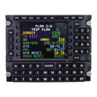
Based on GPS altitude, geometric altitude is a computed
pseudo-barometric altitude (Above Sea Level - ASL) designed
to reduce or eliminate errors potentially induced in Corrected
Barometric Altitude by temperature extremes, non-standard
pressure altitude conditions, and altimeter miss-
ensures an optimal EGPWS Terrain Alerting and Display
capability. Geometric Altitude also allows EGPWS operations
in QFE environments without custom inputs or special
Geometric Altitude requires GPS Altitude input with its
associated Vertical Figure Of Merit (VFOM) and Receiver
Autonomous Integrity Monitoring (RAIM) failure indication,
standard (uncorrected) altitude, Radio Altitude, Ground Speed,
Roll Angle, and aircraft position (Latitude and Longitude).
Additionally, corrected Barometric Altitude, Static Air
Temperature (SAT), GPS mode, and the number of satellites
tracked are used if available.
The Geometric Altitude is computed by blending a calculated
Non-Standard Altitude, Runway Calibrated Altitude (determined
during takeoff), GPS Calibrated Altitud
e, Radio Altitude
Calibrated Altitude (determined during approach), and
Barometric Altitude (if available). Estimates of the VFOM for
each of these are determined and applied in order to determine its
weight in the final altitude.

 Loading...