74 GPS1200 Manage...\Coordinate Systems
11.2 Creating a New Coordinate System/Editing a Coordinate System
Access step-by-
step
)
Editing a coordinate system is similar to creating a new coordinate system. For
simplicity, the screens are called MANAGE XX Coordinate System and differences
are clearly outlined.
MANAGE
XX Coordinate
System
When editing a coordinate system the transformation type of the selected coordinate
system determines the availability and the options of the subsequent fields. Most
fields are identical with those for the creation of a new coordinate system.
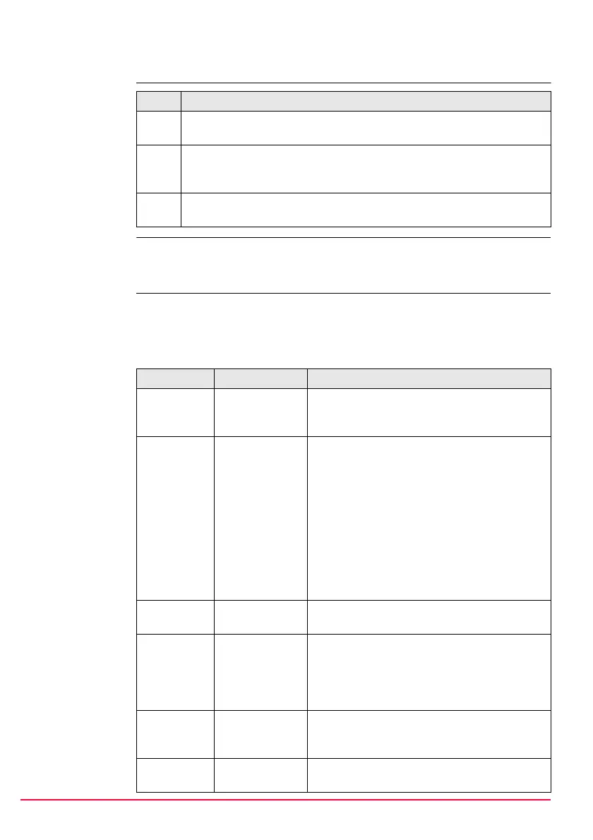
Description of fields
Step Description
1. Refer to "6 Manage... - Getting Started" to access MANAGE Coordinate
Systems.
2. In MANAGE Coordinate Systems highlight a coordinate system. When
creating a new coordinate system, a copy of this coordinate system is
taken for further configurations.
3. NEW (F2)/EDIT (F3) to access MANAGE New Coordinate
System/MANAGE Edit Coordinate System.
Field Option Description
<Name:> User input A unique name for the coordinate system. The
name may be up to 16 characters long and may
include spaces.
<Residuals:> Available for transformations with control points.
The method by which residuals are distributed
throughout the transformation area.
None No distribution is made. Residuals remain with
their associated points.
1/Distance
XX
Distributes the residuals according to the
distance between each control point and the
newly transformed point.
Multiquadratic Distributes the residuals using a multiquadratic
interpolation approach.
<Trans-
form:>
Choicelist The type of transformation.
<Pre Trans-
form:>
Output Available for editing Twostep transformations.
The name of a preliminary 3D transformation
which is used together with the selected projec-
tion to obtain preliminary grid coordinates to be
used for a final 2D transformation.
<Ellipsoid:> Choicelist Available unless projection <Type: Custom-
ised>. The local coordinates are based on this
ellipsoid.
<Projec-
tion:>
Choicelist The map projection.

 Loading...