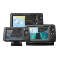
Do you have a question about the Lowrance 12 TS and is the answer not in the manual?
Describes the procedure for powering the unit on and off.
Describes how to save a MOB waypoint in emergencies.
Guides on creating new custom pages with multiple panels.
Identifies and explains the elements of the chart panel display.
Details how to display StructureScan data as an overlay on the chart.
Details the vessel's position, route planning, and waypoint placement.
Covers positioning and managing waypoints, routes, and trails.
Covers settings like pop-up information, range rings, and grid lines.
Accesses advanced edit functions and settings for waypoints, routes, and trails.
Describes how to save a new waypoint using the cursor or vessel position.
Guides on creating a new route by placing routepoints.
Explains trails as graphical presentations of vessel path.
Explains how to start navigation to a selected cursor position.
Details how to start navigation towards a specific waypoint.
Covers initiating navigation along a predefined route.
Covers settings for arrival radius, XTE limit, XTE alarm, and logging type.
Identifies elements of the sonar display like fish arches and depth.
Guides on initiating sonar data recording and saving files.
Provides options for sonar settings like depth offset and temperature calibration.
Explains how to download and update the unit's software.
Recommends backing up waypoints, routes, and settings files.
| GPS | Yes |
|---|---|
| Touchscreen | Yes |
| Sonar | Yes |
| Waterproof Rating | IPX7 |
| Display Size | 12 inches |
| Resolution | 1280 x 800 |
| Networking | Ethernet |
| Sonar Type | CHIRP, DownScan |
| Frequency | 455/800 kHz |
| Operating Temperature | -15°C to 55°C |


