Do you have a question about the Lowrance 5 TS and is the answer not in the manual?
Accessing basic system settings and functions through a dialog.
Procedure for powering the unit on, off, and entering standby mode.
Explanation of standby mode and its power-saving features.
How to activate, move, and use the cursor for positioning and selection.
Overview of the chart display and its key elements like waypoints and routes.
Managing waypoints, routes, and trails on the chart page.
Overview of the GPS plotter display and its components.
Configuration options for the GPS plotter display.
Accessing advanced edit functions and settings for navigation items.
User-generated marks on the chart or GPS plotter panel.
Procedure for saving a new waypoint.
How to reposition an existing waypoint on the panel.
Modifying the information and attributes of a waypoint.
Creating and navigating routes composed of routepoints.
Step-by-step guide for creating a new route by placing routepoints.
How to start recording a new vessel trail.
Guidance for navigating to a specific point selected by the cursor.
Guidance for navigating towards a previously saved waypoint.
Guidance for following a predefined route.
Configuration options for navigation features like arrival radius and XTE alarm.
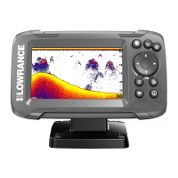
Description of the sonar display and its key components.
How to magnify specific parts of the sonar display.
Special sonar modes for manual tuning and specific fishing conditions.
Adjusting the sonar signal sensitivity for better target detection.
Manual steps to adjust sonar sensitivity levels.
Initiating the recording of sonar data to internal memory or a card.
Halting the ongoing recording of sonar data.
Accessing and configuring various sonar settings.
Understanding the StructureScan display and its key components.
Saving StructureScan data internally or to a memory card.
Description of the DownScan display and its components.
Adjusting DownScan display parameters for optimal viewing.
Advanced DownScan display settings including surface clarity.
Steps to turn on and select the source for StructureScan overlay.
How the system monitors for dangerous situations and system faults.
Core system configuration options like language, text size, and time.
Information and procedures for updating the unit's software.
Step-by-step instructions for downloading and installing software updates.
Recommended procedures for backing up waypoints, routes, and settings.
Manually controlling simulator parameters like GPS source and speed.
| Brand | Lowrance |
|---|---|
| Model | 5 TS |
| Category | Fish Finder |
| Language | English |