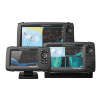
Do you have a question about the Lowrance 5 HDI and is the answer not in the manual?
Details the function of each physical button on the unit, including Pages, Zoom, Arrows, Exit, Menu/Enter, Cursor/Waypoint, and Power.
Explains how to access and navigate the main Home page interface, including the Tools panel and application page icons.
Describes the different application pages, how they are presented, and options for custom pages.
Guides on creating, modifying, and deleting custom pages for personalized layouts with multiple panels.
Provides quick access to essential system settings like Settings, Standby, Power off, Brightness, and Night mode.
Step-by-step instructions for powering the unit on and off using the Power key.
Explains how Standby mode conserves power by turning off the sonar and backlight while keeping the system active.
How to adjust screen brightness and utilize Night Mode for optimal visibility in low light conditions.
Guidance on navigating menus and interacting with dialog boxes using the unit's directional and confirmation controls.
How to activate, move, and utilize the cursor for selection, marking positions, and displaying data.
Instructions for saving a critical Man Overboard (MOB) waypoint at the vessel's current position in emergencies.
Explains how to personalize the Home page background image using system images or custom files.
Details how to display specific data information as an overlay on various pages for quick reference.
Step-by-step guide to creating new pages with multiple data panels by selecting and arranging elements.
How to modify the screen layout ratios for multi-panel displays to optimize viewing areas.
Identifies and explains the various elements displayed on the Chart panel, such as waypoints, routes, and grid lines.
How to choose and configure different chart display types and their associated settings.
Describes how to move the chart view across the screen using directional controls to explore different areas.
How to manage navigation points, create routes, and view recorded trails on the chart display.
Utilizing the chart function for navigation tasks, including following routes and reaching waypoints.
How to search for specific chart items, points of interest, and locations using the 'Find' menu.
Explains how to overlay StructureScan data onto the chart for enhanced underwater environment visualization.
Details specific settings and features available for C-MAP charting, such as chart detail and depth palette.
Information on using Navionics charts, including requirements, compatibility, and feature activation.
Features unique to Navionics charts like Community Edits, SonarChart Live, and dynamic tide icons.
Accessing and configuring various chart display preferences, including chart source, pop-up information, and range rings.
Identifies the elements and information displayed on the GPS plotter screen, including vessel position, trails, and routes.
How to move the GPS plotter display across the screen using the unit's directional controls.
Options related to GPS overlay, such as StructureMap, and image orientation settings (North up, Course up).
Configuration of GPS plotter parameters including pop-up information, range rings, grid lines, and course extension.
Accessing advanced functions and settings for managing navigation data like waypoints, routes, and trails.
Step-by-step guide on how to save a new waypoint accurately at the vessel's or cursor's position.
Procedure for repositioning an existing waypoint on the display using the cursor and menu options.
How to modify the attributes and details of a selected waypoint via the Edit Waypoint dialog.
Instructions for defining a new route by setting multiple route points sequentially on the panel.
How to modify existing routes directly on the display panel by selecting and editing route points.
Explains the process of transforming recorded trails into navigable routes for planning and navigation.
Describes trails as graphical recordings of historical vessel movement, useful for retracing paths.
How to initiate the recording of a new vessel trail, specifying tracking parameters.
How to initiate navigation towards a specific point marked by the cursor on any chart or sonar panel.
Procedure for starting navigation towards a pre-saved waypoint, guiding the vessel to its location.
How to follow a defined route for guided travel, including options to cancel or skip waypoints.
Configuration of parameters influencing navigation accuracy and behavior, such as arrival radius and XTE limit.
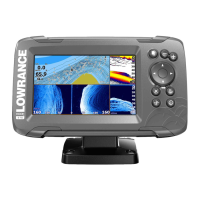
Identifies key elements and readings within the sonar display, such as fish arches, depth, and frequency.
How to enlarge specific areas of the sonar display for detailed viewing using the unit's zoom controls.
Method for reviewing past sonar data by panning the display to scroll through historical information.
Adjusting sonar image parameters like mode, range, and sensitivity for optimal performance in various conditions.
Accessing manual sonar tuning controls specific to Custom or Ice Fishing modes for finer adjustments.
How to adjust sensitivity to enhance or reduce target detail on the sonar display for better interpretation.
Explains the automatic adjustment of sonar return levels for optimal performance, with manual override capability.
Step-by-step guide to manually fine-tune the sonar sensitivity using the adjustment scroll bar.
Configuration of advanced sonar parameters like ping speed, scroll speed, noise rejection, and surface clarity.
Accesses additional sonar display features like split screen options, zoom bars, and flasher mode.
A mode that flattens the seabed for better viewing of bottom-hugging targets and echoes close to the bottom.
How to measure distances directly on the sonar image using the cursor to mark two points.
Procedures for initiating and saving sonar data recordings internally or to a memory card.
How to cease the active recording of sonar data using the System Controls or Logging Sonar dialog.
Method for reviewing previously saved sonar log files using the 'View Sonar log' option.
Accessing and configuring various sonar operational parameters, including log sonar and depth offset.
Adjusting depth readings to compensate for the transducer's vertical position relative to the boat's hull.
Calibrating the unit's water temperature sensor readings for improved accuracy.
Explanation of the StructureScan image, its high-resolution detail, and display capabilities (left/right side).
How to magnify sections of the StructureScan image for closer inspection using the zoom keys.
How to position and interact with the cursor on the StructureScan display for analysis and measurement.
Method for reviewing past StructureScan data by panning the image to scroll through historical records.
How to record and save StructureScan data internally or to a memory card for later analysis.
Customizing StructureScan image settings by selecting between Auto and Custom modes.
Specific settings for StructureScan customization including range, frequencies, and contrast adjustments.
Configuration of advanced visual parameters for StructureScan images, including surface clarity and restore defaults.
Access to additional features like image flipping, range lines, palettes, and measuring distance on StructureScan.
Explanation of the DownScan imaging technology, its detailed structure visualization, and display elements.
How to enlarge portions of the DownScan image for closer inspection using the zoom keys.
How to position and use the cursor on the DownScan display for analysis, measurement, and navigation.
Method for reviewing past DownScan data by panning the image to scroll through historical records.
Adjusting DownScan image parameters like mode, range, and frequency for optimal clarity and detail.
Specific settings for DownScan customization including range, frequency, restore defaults, and contrast.
Configuration of advanced visual parameters for DownScan images, including surface clarity and measuring distance.
Shows a chart panel with Structure overlay, combining chart data with SideScan images for underwater visualization.
How to enable the StructureScan overlay feature on the chart menu, making Structure data appear on screen.
Advice for optimizing the capture and interpretation of StructureMap data, including scanning techniques.
How to record StructureScan data when Structure overlay is enabled, for later conversion or analysis.
Process for converting recorded StructureScan log files (.sl2) into StructureMap format (.smf).
How to integrate StructureMap data with compatible charting cards and manage files on the unit.
Settings for transparency, palette, contrast, water column display, and clearing live history for StructureMap.
How the system monitors for and alerts to dangerous situations or system faults using audible and visual notifications.
Classification of alarms by color coding (Red, Orange, Yellow, Blue, Green) and their corresponding importance levels.
Procedures for acknowledging and handling active alarm notifications, including closing or disabling them.
Accessing alarm settings, including siren activation, configuring individual alarms, and viewing alarm history.
Access point for configuring system and application-specific settings, including language, time, and display.
General configuration options for language, text size, key beeps, time zone, datum, and coordinate system.
Settings related to navigation features like arrival radius, XTE limit, trails, and logging type.
Settings that control chart display, data presentation, and feature options for all chart panels.
Settings that configure the sonar performance, display modes, and data logging functionalities.
Settings for managing audible and visual alarms, including siren control and alarm history.
Configuration of measurement units for various data types displayed on the unit.
Options for listing, editing, or deleting navigation data entries like waypoints, routes, and trails.
Access to environmental information such as Sun, Moon phases, Tides, and Trip data.
Access to the unit's file management system for browsing and managing files on internal memory and SD cards.
Guidance on basic care and protection of the unit, recommending the use of a protective sun cover.
Instructions for safely cleaning the screen and unit housing using appropriate materials and methods.
Visual inspection procedures for unit connectors to ensure they are clean and correctly positioned.
How to generate a diagnostic report containing system information for technical support inquiries.
Information and procedures for downloading and installing the latest software updates for the unit.
Recommended methods for backing up user-created data (waypoints, routes, trails) and system settings.
How to export all navigation data entries for backup purposes, detailing various file format options.
Process for clearing deleted navigation data from memory to potentially improve system performance.
Instructions for restoring backed-up data from a memory card to the unit.
How the unit simulates its functions automatically for product demonstrations and retail showroom displays.
How to select sonar data files, including recorded logs, to be used by the simulator for realistic operation.
Fine-tuning simulator parameters such as GPS source, simulated course, speed, and start position.
| GPS | Yes |
|---|---|
| Waterproof Rating | IPX7 |
| Display Size | 5 inches |
| Frequency | 83/200 kHz, 455/800 kHz |
| Display Type | Color LCD |
| Power Input | 10-20V DC |
| Operating Temperature | -4°F to 131°F (-20°C to 55°C) |