Do you have a question about the Lowrance Elite-5 HDI and is the answer not in the manual?
Details the function of the unit's physical buttons and keys.
Guides on turning the unit on/off, setting MOB waypoint, and selecting GPS source.
Guides on microSD card usage and introduces Conventional and DownScan sonar.
Initial setup wizard and selection of display pages.
Accessing and interacting with various menu types and items.
Using the keypad for cursor movement and navigating to specific locations.
Explains Advanced Mode, Standby, and Restore defaults.
Reviewing sonar history and controlling transducer ping rate.
Adjusting contrast, range, frequency, noise rejection, and clarity.
Accessing sonar menus and reviewing sonar history.
Configuring sensitivity, colorline, range, ping speed, and sonar options.
Accessing chart menu and creating new waypoints.
Managing waypoints, creating/navigating routes, and handling trails.
Creating, editing, and displaying trails.
Configuring map data, grids, and navigation parameters.
Accessing installation and configuration settings via the settings menu.
Adjusting language, audio, GPS source, time, and calculator settings.
Enabling alarms, selecting units, managing screenshots, and viewing software info.
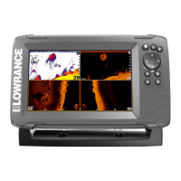
Details on case size, display, waterproof standard, transducer, and max depth.
Information on GPS antenna, mapping card slot, and compatibility.
| Display Size | 5 inches |
|---|---|
| Display Resolution | 480 x 480 pixels |
| Sonar Frequency | 83/200 kHz, 455/800 kHz |
| GPS | Yes |
| Memory Card Slot | MicroSD |
| Operating Voltage | 12 V DC |
| Waterproof Standard | IPX7 |
| Display Type | Color TFT LCD |
| DownScan Imaging | Yes |
| Power Output | 250W RMS |
| Operating Temperature | -15°C to +55°C |
| Dimensions | 6.9" x 5.4" x 2.5" (175 mm x 136 mm x 63 mm) |
| Weight | 1.5 lbs (0.68 kg) |