Do you have a question about the Lowrance Hook Reveal Series and is the answer not in the manual?
Instructions for powering the system on and off using the Power key and dialog.
Accessing basic system settings quickly via the Power key press.
How to enter and exit standby mode to save power.
Navigating menus, selecting options, and confirming dialog entries.
How to activate, position, and remove the cursor on the display panels.
Creating a MOB waypoint in an emergency situation for quick return.
Procedure for removing a Man Overboard waypoint.
How to cancel navigation guidance towards a MOB waypoint.
Step-by-step guide to creating new custom pages with multiple panels.
How to modify existing custom pages or remove them from the system.
Identifies key elements on the chart panel like North indicator and vessel symbol.
Adding and managing chart overlays like Structure and Genesis live.
Configuring transparency, contour interval, and depth palettes for Genesis live.
Details on chart detail levels and the Genesis Layer for C-MAP charts.
Community edits, SonarChart, and SonarChart Live features for Navionics.
Accessing waypoint, route, and trail dialogs and waypoint basics.
Instructions for saving new waypoints and repositioning existing ones.
Modifying waypoint details and removing waypoints from the system.
Step-by-step process for creating a new route by defining routepoints.
How to modify route details, add/remove points, or delete a route.
Combining existing waypoints to form new routes.
Explains trails as a graphical history of vessel movement for retracing paths.
Starting new trails, configuring logging types, and coloring trails.
Overview of navigating to cursor, waypoints, or predefined routes.
Initiating navigation to a selected point on the chart or sonar panel.
Starting navigation towards a specific waypoint or along a defined route.
Adjusting arrival radius, XTE limits, and logging types for navigation.
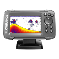
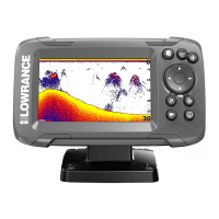
Explains the sonar display elements like fish arches, depth, and frequency.
Starting, stopping, and managing sonar log recordings.
Configuring image settings, modes, and advanced options for sonar display.
Adjusting range, frequency, and sensitivity, including auto sensitivity.
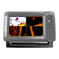
Using split screen views, zoom, and bottom lock mode for sonar.
Accessing sonar settings, viewing logs, and managing sonar data.
Steps for downloading and installing software updates from a website.
Recommendations for regularly backing up user data and system settings.
| Autotuning Sonar | Yes |
|---|---|
| FishReveal | Yes |
| GPS | Yes |
| Waterproof Rating | IPX7 |
| Operating Temperature | -15°C to 55°C (5°F to 131°F) |
| Display Type | SolarMAX™ |
| SD Card Slot | Yes |
| Power Supply | 12V DC |
| Storage Temperature | -20°C to 60°C (4°F to 140°F) |
| Display Size | 5" or 7" or 9" |