Do you have a question about the Magellan RoadMate 5190T and is the answer not in the manual?
Details on maximum operating temperature and battery properties, including non-removability.
Instructions and safety guidelines for charging the device using approved adapters and checking temperature limits.
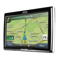
Outlines the main functions of the Magellan RoadMate, such as saving destinations and routing.
Identifies key physical components like the power switch, Micro-SD slot, and Mini-USB port.
Provides tips for choosing the optimal and legal mounting location for the receiver in a vehicle.
Step-by-step guide on cleaning the windshield and attaching the car cradle securely.
Instructions on connecting the Magellan RoadMate receiver to the assembled mount.
Guide on connecting the device to the vehicle's power receptacle.
Details on how to turn the receiver on/off and perform a reset.
Advice on preventing theft by not leaving the device visible when unattended.
Steps for turning the Magellan RoadMate receiver on and off via the power button.
Guidance on entering vehicle details like height, width, and weight for accurate routing.
Instructions for pairing a mobile phone with the Magellan RoadMate using Bluetooth.
How to view the battery level indicator and GPS signal strength on the device.
Methods for adjusting the device's audio volume from the map screen or settings.
Instructions on how to adjust the screen brightness for optimal viewing.
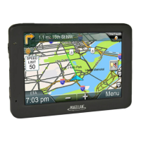
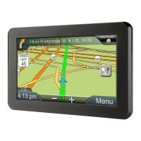
Description of the main menu interface, icons, and how to access it.
Explanation of the on-screen keypad buttons and their uses for data entry.
Tips for efficient data entry and navigating through lists of options.
How the Smart City Search feature predicts and suggests cities based on input.
Utilizing QuickSpell for faster and more accurate city and street name entry.
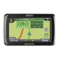
Describes the two display modes: normal mode for general viewing and routing mode for navigation.
Covers accessing map options, setting map modes (2D/3D), zoom levels, and panning.
Displays current position details and the list of upcoming navigation maneuvers.
Provides steps to modify a route by avoiding specific maneuvers or streets.
Instructions for assigning addresses and POI search criteria to OneTouch icons for quick access.
How to initiate navigation to a destination or search saved in the OneTouch menu.
Step-by-step guide to entering a full street address for route calculation.
Tips for faster and more accurate address entry, including using lists and ZIP codes.
How to set a destination by specifying two intersecting streets.
Option to route to the geographical center of a city without a specific address.
How to select and navigate to destinations previously visited.
Process for saving past destinations into the device's address book.
Instructions on how to delete the list of previously visited destinations.
Accessing, adding, and editing entries within the device's address book.
Guide on finding and routing to Points of Interest based on predefined categories.
Instructions for searching and navigating to Points of Interest using their names.
How to find and navigate to Points of Interest located near highway exits.
Creating routes with multiple stops by adding additional destinations sequentially.
How to modify an existing multi-destination route, reorder, or optimize stops.
Details on how the map screen displays route information and upcoming maneuvers.
Overview of different methods for calculating routes, such as fastest time or shortest distance.
How to permanently change the preferred method for route calculation.
Covers cancelling routes, detouring, and the SmartDetour™ feature on freeways.
Steps to access and view the vehicle profile settings on the device.
Entering vehicle height, width, length, and type for tailored routing.
Specifying the hazardous material type for routing restrictions and compliance.
Definitions of traffic terms and how traffic incidents are displayed on the map.
Options to select and avoid specific traffic delays along the current route.
How to navigate to and enter the main system settings menu.
Configure device language, auto-power off duration, and screen brightness.
Choosing between 12-hour or 24-hour time display format.
Set the local time zone and select preferred units for distance and speed.
Adjust map appearance, orientation, POI visibility, and auto-zoom features.
Enable lane assist, adjust volume, mute sounds, and control button feedback.
Configure default route methods, turn warning sounds, U-turn guidance, and toll road avoidance.
Customize keyboard layout and configure live traffic display and audible warnings.
Set GPS position manually and check satellite signal status.
Reset device to factory defaults and view serial number and software version.
Set audible/visible speed warnings and select installed map regions.