Do you have a question about the Magellan RoadMate N393M Series and is the answer not in the manual?
Specifies operating temperature limits and notes the battery is rechargeable.
Details safe charging practices, including adapter use, temperature, and time.
Explains FCC compliance and how to correct interference.
States compliance with Canadian Interference-Causing Equipment Regulations.
Confirms compliance with IC radiation exposure limits.
Lists features like saving searches, routing to home, POIs, AAA TourBook, and traffic info.
Discusses battery use, indoor GPS signal limitations, and voice alerts.
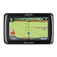
Labels and identifies the power button, speaker, screen, and connectors on the device.
Provides step-by-step instructions for turning the device on and off.
Explains how to view battery level and GPS signal strength.
Guides on how to control audio volume from the map display.
Guides users on changing volume through the device's Settings menu.
Instructions for enabling or disabling audible feedback for button presses.
How to set screen brightness and manage battery-saving dimming.
Introduces the Main Menu screen and its icons for major functions.
Explains the purpose of icons like Address, Points of Interest, and Previous.
Details buttons for Address Book, Intersection, Settings, Current Location, and TourDirector.
Shows the layout of the on-screen keyboard for data entry.
Explains data input fields, lists, and specific keypad buttons.
Guides on navigating and choosing items from presented lists.
How to switch between QWERTY and ABC keyboard input methods.
Useful advice for accurate data input and search result refinement.
Describes the feature that predicts cities based on user input and location.
Demonstrates how Smart City Search predicts city names with examples.
Details QuickSpell for easier and error-free city and street name entry.
Provides tips for choosing the optimal placement for the receiver in the vehicle.
Step-by-step guide to connect the receiver to its car cradle.
Instructions for connecting the car cradle to the car mount assembly.
Details on how to properly connect the power cable to the car cradle.
Explains how to firmly attach the cradle to the windshield mount.
Guides on positioning the receiver for optimal screen visibility.
Instructions for plugging the power adapter into the vehicle's 12V receptacle.
How to check if the receiver is receiving power from the vehicle.
Describes how to turn the receiver on/off and use suspend mode.
Recommends keeping the receiver out of sight when unattended to prevent theft.
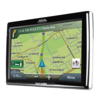
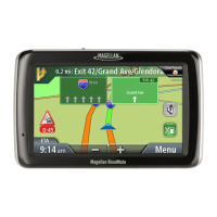
Explains the elements and information shown on the map in normal mode.
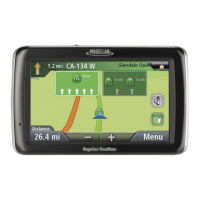
Details the additional information shown on the map during active routing.
Instructions on how to navigate to the Map screen from the Main Menu.
How to switch between 2D and 3D map perspectives.
How to zoom in or out on the map using on-screen controls.
Guides on moving the map display to view different areas.
Steps to set a destination by tapping a specific point on the map.
How to open the screen displaying current position, intersections, and coordinates.
Steps to save the current GPS position to the Address Book or OneTouch.
How to view the detailed list of upcoming route instructions.
Method to modify the route by avoiding specific streets or turns.
How to adjust the audio volume from the map interface.
Detailed steps for adjusting volume using map screen controls.
Step-by-step process to enter a complete address for routing.
Advice on efficient address input using software features.
How to set a destination using the intersection of two streets.
Method to route to the geographical center of a selected city.
Steps to select and navigate to previously visited locations.
How to save a past destination into the Address Book for future use.
Instructions for deleting the history of previous destinations.
How to find and open saved addresses within the Address Book.
Steps to initiate navigation to an address stored in the Address Book.
How to add a new address manually to the Address Book.
Method to save Points of Interest as entries in the Address Book.
Assigning favorite destinations to OneTouch buttons for quick access.
How to modify or re-assign existing OneTouch buttons.
Assigning POI search criteria to OneTouch buttons for faster searches.
Steps to start a route using a pre-configured OneTouch button.
Explains how to manage destinations when creating multi-stop routes.
Steps to find and navigate to Points of Interest based on their categories.
Accessing and routing to POIs from the AAA TourBook database.
How to find and navigate to POIs by searching for their specific names.
Guide to finding and routing to Points of Interest near highway exits.
Details on services like gas stations and restaurants available near freeway exits.
Instructions for setting a preferred address as 'Home' for quick access.
How to update or re-assign the saved Home Address.
Steps to initiate routing to the designated Home Address.
Clarifies that routing to Home replaces an active route automatically.
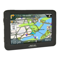
Explains the map display and information shown while following a route.
How the Maneuver List provides step-by-step directions for the route.
Refers to other sections for details on different route creation methods.
How to select different route calculation methods (e.g., fastest time).
How to choose a permanent default method for all routes.
Steps to stop or cancel the current navigation route.
How to find and select alternative routes around traffic or road closures.
Explains the automatic detour feature when encountering slow traffic on freeways.
Steps to add multiple destinations to a single route.
How to reorder, add, or remove destinations from a multi-stop route.
Instructions for saving a multi-destination route to the Address Book.
Defines key terms related to traffic data and services.
How traffic incidents are shown on the map and affect arrival time.
How to opt out of routing through areas with traffic delays.
Steps to select specific traffic delays to avoid on the route.
Information about available coupons and offers related to POI searches.
How to get more details about a displayed coupon or offer.
How to browse all recent coupons and offers upon reaching a destination.
Steps to navigate to the main system configuration menu.
How to change the display language of the receiver.
Setting the duration for automatic device power off when idle.
How to modify screen brightness and enable battery-saving dimming.
Choosing between 12-hour and 24-hour time displays.
Setting the correct time zone and managing daylight saving time.
Selecting preferred units for distance, temperature, etc.
Configuring automatic switching between day and night map color schemes.
How to set map display to follow heading or maintain North Up orientation.
How to toggle the display of various Points of Interest icons on the map.
Enabling the map to zoom in automatically when approaching turns.
Activating visual guidance for highway lane selection based on signs.
How to change the main volume level via the Settings menu.
Enabling the mute function to silence all audio output.
Turning off audible confirmation for button presses.
Choosing the preferred algorithm for calculating routes (e.g., fastest time).
Selecting the audio alert for upcoming turns.
Allowing the device to incorporate U-turns into route calculations.
Configuring the device to exclude toll roads from calculated routes.
How to switch between QWERTY and ABC keyboard input layouts.
Process for entering codes to activate extra functionalities or updates.
Activating the reception of real-time traffic information.
Configuring pop-up notifications for traffic events.
Setting up audible alerts for traffic warnings.
Optimizing GPS position calculation for quicker satellite acquisition.
How to check the current status of GPS satellite reception.
Steps to reset all device settings to their factory defaults.
Accessing details about the device, including serial number and software version.
How to find and open the recorded trip history.
Examining the specific data for an individual recorded trip.
How to access an overview of all recorded trips, including totals.
Steps to navigate to the configuration options for speed warnings.
Setting audible and visual alerts for exceeding speed limits.
Enabling the display of speed limit signs on the map interface.
Adjusting the speed threshold at which warnings are triggered.