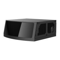
Appendix A RSView
This appendix explains how to use RSView to record, visualize, save and review of
the data from RS-LiDAR-M1.
The original sensor data can be also captured and examined by using other free of
charge tools, such as Wireshark or tcp-dump. But visualization of the 3D data through
using RSView is easy to realize. User may contact RoboSense technical support for the
specific RSview Version.
A.1 Software Features
RSView supports real-time visualization of 3D coordinate data from RS-LiDAR-M1.
RSView also supports review of the pre-recorded data stored in “pcap” (Packet Capture)
files, however, RSView doesn’t support direct importing of “.pcapng” files at the moment.
RSView displays directly the point cloud that is exchanged from the measured
distance from RS-LiDAR-M1. It supports changing the display mode of point cloud
according to XYZ coordinates, distance, pitch(elevation) and yaw(azimuth), etc.
Function and features of RSView are as shown below:
Online visualization of sensor data over Ethernet
Record of real-time data into pcap files
Review of the recorded point cloud from pcap files
Different visualization mode based on distance, pitch(elevation) and
yaw(azimuth), etc.
Tabular display of point cloud data
Tool for measuring distance from visualized cloud point
A.2 Install RSView
Installation packet of RSView is suited for Windows 64-bit system and it requires no
other dependent software packets. Unzip the compressed packet of RSView, the
RSView.exe executable file can be found in the /bin folder.
A.3 Set Up Network

 Loading...