Shortly before navigating a motorway junc-
tion or exit, the display will show a three-
dimensional representation
of the lanes and
the exit. Lane Keeping Assist is not available
for all junctions in all countries.
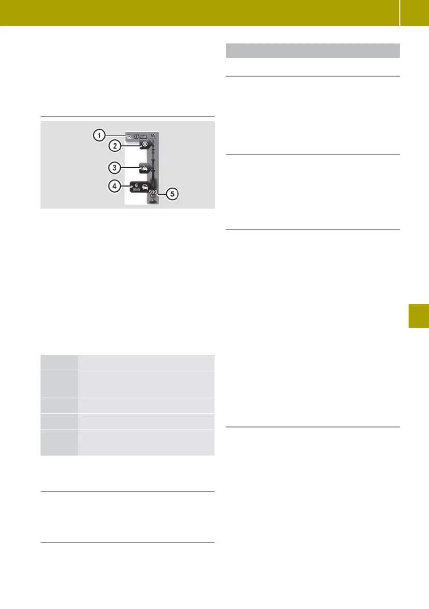
Traffic information details
:
Overall delay on route
;
Traffic disruption (packed snow)
=
Traffic disruption (rain)
?
Traffic disruption (traffic jam)
A
Current location and distance to next
traffic disruption
During route guidance, traffic information is
shown for the route ahead. When there are a
number of traffic disruptions in quick suc-
cession,
only
the very next disruption on the
route will be displayed.
Traffic information is not available in all
countries and regions.
Colour Meaning
Grey Unknown or unexplained situa-
tion
Orange Slow-moving traffic
Red Traffic jam
Dark
red
Standstill or road blocked
Calling up more detailed information
about the traffic problems
X
Tap on the display for traffic information
during route guidance.
Scrolling through the traffic reports
X
Tap on the message on the touchscreen and
swipe left or right.
Displaying the map for a location
Useful information
With the “View map” function, the display
shows a two-dimensional map. The map
shows your current position, as well as a
number of other elements, such as Favour-
ites.
Displaying a map
X
Select Navigation >
View map.
A map of the surrounding area will be
shown.
X
To search, select W > Search.
Controlling the map view
Moving the map
X
Tap on the centre of the touchscreen.
X
Swipe in the desired direction. The map
will then
move in the respective direction.
Zooming in on the map
X
Place two fingers slightly apart in the
middle of the touchscreen.
X
Move your fingers away from each other.
Reducing the scale of the map
X
Place two fingers, at a greater distance
apart, on the screen.
X
Pull your fingers towards each other.
Showing and hiding additional informa-
tion on the map
X
Select Navigation
>
View map.
X
Select W > Change map information.
X
Select one of the following information
options:
R
Traffic information
R
Names
R
Points of interest (POIs)
R
Satellite images
R
Coordinates
Using the navigation system
119
>> Using the smart Media-System.
Z
 Loading...