English
8
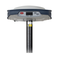
Left-Side View
• [16]: Rubber flap protecting the USB connector. To
preserve watertightness, ALWAYS KEEP FULLY CLOSE
when you don’t need to use the USB port.
• [17]: USB connector emulating standard RS232 serial
port (port B). For use in troubleshooting only.
Phase Center
Location
See diagram below. These are relative measurements.
The field software usually calculates the real height of the
instrument, based on the location of the L1 phase center.
Whether you provide a vertical or slant measurement of the
antenna base (ARP), the field software you are using should
be able to deduce the real height of the instrument, using the
pre-loaded dimensional parameters (antenna radius, etc.)
specific to the model of GNSS antenna used.
In the case of a slant measurement, the software will also use
the radius of the antenna to determine the instrument height.
L1 84.6 mm
L2 77.6 mm