Do you have a question about the Standard Horizon CP590 and is the answer not in the manual?
Instructions for bracket and flush mounting the GPS Chart Plotter.
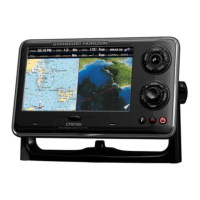
Detailed steps for mounting the GPS Chart Plotter using a bracket.
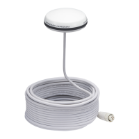
Guidance on mounting the external GPS WAAS antenna for optimal reception.
Details on connecting NMEA devices like AIS receivers, PCs, and fish finders.
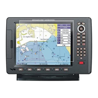
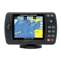
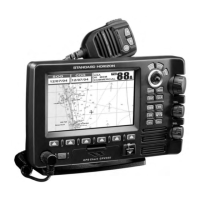
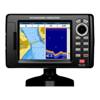
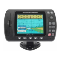
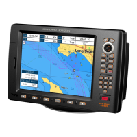
Description of keys, ShuttlePoint knob, and their functions.
Guide to powering on, cursor modes, speed settings, and time setup.
Options for chart orientation, color, language, and soft key customization.
Selecting display pages and customizing data windows.
Using the INFO key to search for points of interest and services.
Locating port services nearest to the vessel's position.
Finding and displaying information about nearby ports.
Details on the built-in coastal navigation charts for various regions.
Accessing and configuring various map display functions.
Selecting between Standard and Flexi-Zoom for chart scaling.
Procedures for creating a mark at a specific location on the chart.
Modifying existing marks, including position, name, and icon.
Creating or editing marks directly within the user points list.
Setting navigation to a cursor position, saved route, or mark.
Activating the MOB feature to mark the vessel's position.
Removing a MOB point from the chart.
Step-by-step guide to creating a route by adding waypoints.
Creating a route by selecting existing marks on the chart.
Selecting a route to navigate towards.
Analyzing a route for potential navigation hazards.
Recording vessel's path and location data.
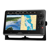
The primary display page for chart viewing and navigation functions.
Displaying navigation information with compass rose or tape.
Showing a 3D view of vessel travel for navigation.
Monitoring GPS satellite reception and status.
Displaying data from external NMEA devices in customizable windows.
Verifying NMEA data transmission from connected devices.
Using DSC for distress calls and position requests.
Configuring NMEA, AIS, and RADAR input/output ports.
Customizing coordinate systems, chart datum, and navigation settings.
Setting up audible and visual alarms for navigation safety.
Using the built-in simulator for practice and familiarization.
Enabling or disabling DSC features like auto position and auto info.
Connecting the MOBILARM system to the GPS Chart Plotter.
Information about MOBILARM Personal Transponder (PTX) devices.
Handling MOB alerts received from MOBILARM.
Solutions for common problems like power, GPS fix, screen, and responsiveness.
Performing an extended auto-test to diagnose problems.
Clearing RAM to reset the device to factory defaults.
Comprehensive list of technical specifications for the CP590 device.
| Display Type | Color TFT |
|---|---|
| Chart Plotting | Yes |
| Waterproof Rating | IPX7 |
| WAAS | Yes |
| Backlit Display | Yes |
| NMEA 0183 | Yes |
| NMEA 2000 | Yes |
| Accuracy | 3 meters (10 ft) |
| Time to First Fix | Approx. 45 seconds |
| Power Supply | 12V DC |
| Chart Compatibility | C-MAP |
| Display Size | 5 inch |