Do you have a question about the Standard Horizon CPN1010i and is the answer not in the manual?
Important warnings and cautions regarding product usage and safety precautions.
Built-in charts for coastal navigation of USA, Alaska, Hawaii, Great Lakes, Canada, Bahamas, Caribbean, Cuba, Mexico, Puerto Rico, Central America.
Procedure to update built-in charts using a Chart Update Card from C-MAP USA.
Step-by-step guide to create, name, and modify routes using waypoints or marks.
Accessing and managing Wi-Fi connections, including setup and controls.
Instructions for physical installation of the chart plotter and optional GPS antenna.
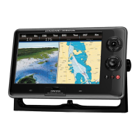
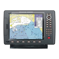
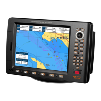
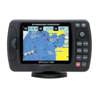
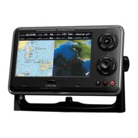
Detailed technical specifications for both CPN700i and CPN1010i models.
Procedures for powering up the chart plotter and shutting it down safely.
Identifies and describes the physical buttons and controls on the chart plotter.
Explains touchscreen gestures, calibration, and the on-screen keyboard.
Details menu elements, warning windows, information windows, and item selection.
Explains the functions of the physical keys, ShuttlePoint Knob, and Rotary Knob.
How to play background music and use soft keys for navigation and functions.
Initial steps to start and use the chart plotter mode, including warnings.
Explains how to switch between Home and Cursor modes and pan the chart.
Demonstrates how to navigate through menus and select different pages like Dual Chart.
Adjusts cursor speed and changes the vessel's ship icon appearance.
Sets chart orientation (North Up/Course Up) and selects different display pages.
Sets time parameters and customizes soft keys for quick page access.
Selects coordinate display format and customizes screen colors.
Changes display language and manages the chart control icon for chart manipulation.
Configures the safety status bar and cursor speed for chart display.
Measures distances on the chart and customizes chart window data displays.
Manages chart boundaries, language, auto info popups, and home mode revert settings.
Introduction to C-MAP 4D charts and their features for boating navigation.
Details the features of MAX and FULL 4D chart content, including 3D views and raster charts.
Explains Value Added Data menu and the procedure for safely removing an SD card.
How to find port services and locate them nearest to the vessel's position.
How to change the displayed date and select a tide station for tide predictions.
Feature to locate wrecks and obstructions nearest to the vessel's position.
How to get detailed information about lakes and locate them by name.
How to search for points of interest by category/type and for user-created points.
How to enter coordinates and retrieve information about chart positions.
Settings for 4D chart features, chart window selection, and switching between 2D/3D display modes.
How to overlay satellite, raster charts, or chart shading and set overlay modes.
Adjusts chart transparency and the 3D exaggeration factor for visual depth.
Adjusts the size of chart icons and place names for better visibility.
Configures the safety status bar to display function status and warning conditions.
Displays tidal current information and allows changing the chart display language.
Sets chart orientation and selects symbology for navigational aids.
Controls the appearance and position of the ship icon on the chart.
Displays course time lines and compass direction indicators on the chart.
Detailed steps for creating new marks and editing existing marks or waypoints.
Procedures for deleting and repositioning marks or waypoints on the chart.
Creating routes from waypoints or marks, and understanding route differences.
Step-by-step guide to creating routes using waypoints and naming them.
Creating multiple routes and inserting waypoints into existing routes.
Procedures for deleting routes and using the route check function for safe navigation.
Explains route checking for hazards and parameters for Easy Routing (ER).
Configuring and activating Easy Routing for automatic route calculation based on boat parameters.
Navigating to a cursor position or a selected route using the GOTO function.
Navigating to saved marks or waypoints and using the ShuttlePoint Knob for control.
How to activate, place, and delete a Man Over Board (MOB) point.
Setting track intervals and recording vessel tracks on the chart.
Procedures for saving, deleting tracks, and configuring track line appearance.
Customizing data windows for trip log and resetting the log.
Using the SD card for backups, transferring files, and formatting the card.
Procedures for loading and deleting files to and from the SD card.
Steps to replace the SD card with a new one.
How to access the Main Menu and select pages using icons and the ShuttlePoint Knob.
How to display a single chart or two charts simultaneously for independent setup.
Selects display modes (Full, Medium, Low, Radar) and configures auto info for objects.
Controls display of marine features like place names, nav-aids, tides, and depth shading.
Configures Latitude/Longitude grids and boundaries mode for chart display.
Manages chart boundaries and Value Added Data boundaries display.
Displays a 3D highway view for navigating to destinations or marks.
Option to display both chart and highway pages on the same screen.
Shows compass heading and navigation information.
Displays GPS status, satellite reception, and allows GPS source and speed configuration.
Displays NMEA data from external devices and customizes data boxes.
Views NMEA sentences transmitted to or received from external devices.
Accessing fish finder displays and tide information for safe navigation.
Explains DSC functionality, distress calls, and position requests for VHF radio.
Manages DSC directory entries and selects video input sources and menus.
Selects video image types (Full Screen, PIP) and adjusts video settings.
Customizes coordinate system, chart datum, orientation, and static navigation settings.
Configures compass bearings, variation, calibration, and NMEA 0183/RS422 connections.
Selects NMEA output sentences and configures audible and visual alarms.
Configures grounding alarm and uses the built-in simulator for training.
Enables/disables DSC features and accesses the About page for system information.
Views data access manager reports and defines AIS system parameters.
Displays AIS targets and configures AIS menu settings for collision avoidance.
Shows the AIS list and uses color to depict the type of AIS ship shown on chart.
Procedures for accessing the Connection Manager from Chart Plotter mode or Start Up screen.
Lists available Wi-Fi hotspots and details supported Wi-Fi standards.
Details connection manager controls and the process of connecting to Wi-Fi hotspots.
Setup for networking two CPN Series Chart Plotters to share charts and data.
Steps to configure network settings and select Chart Plotter 1 for data sharing.
Steps to configure network settings and select Chart Plotter 2 for data sharing.
Explains custom setup for future updates and activating Bluetooth devices.
Step-by-step guide to pair Bluetooth wireless mouse and keyboard with the plotter.
Procedures to launch the internet browser from Chart Plotter mode or Start Up screen.
Overview of the browser interface, home page, and available controls for navigation.
Instructions for web navigation, managing favorite pages, and history lists.
Procedures to launch the media player as a standalone or background application.
Instructions for mounting the chart plotter using a swivel bracket or flush mounting.
Details how to connect power and accessory cables, including fuse installation.
Important warnings about installation and proper grounding procedures for safety.
Configures port inputs for devices and selects NMEA output sentences.
Examples of connecting VHF radio and fish finder devices via NMEA 0183.
Details the video input connector and connection for the CPN700i model.
Connects to external amplifiers/speakers and uses USB thumb drives for media.
Connects optional external alarms and GPS antennas to the plotter.
Information on the optional FF525 Black Box Fish Finder.
How to enter and perform the extended auto-test to diagnose problems.
Resets internal memory and adjusts screen brightness.
Tests the SD card and serial ports for functionality and data integrity.
| Display Size | 10.1 inches |
|---|---|
| Waterproof Rating | IPX7 |
| GPS Receiver | High-sensitivity GPS/GLONASS |
| Chart Plotter | Yes |
| Dimensions | 11.4" W x 9.4" H x 4.2" D (290 x 239 x 107mm) |
| Weight | 6.2 lbs (2.8kg) |
| SD Card Slot | Yes |
| Wi-Fi | Yes |
| Bluetooth | No |
| NMEA 2000 Support | Yes |
| Display Type | LCD |
| Chart Compatibility | Navionics |
| GPS | Yes |