EasyManua.ls Logo

Standard Horizon CPV350 User Manual

Standard Horizon CPV350
144 pages
To Next Page IconTo Next Page
Page #1 background imageLoading...
Page #1 background image
CPV350
GPS Chart Plotter
with VHF FM Marine Transceiver
OWNER'S MANUAL

Table of Contents

Question and Answer IconNeed help?

Do you have a question about the Standard Horizon CPV350 and is the answer not in the manual?

Standard Horizon CPV350 Specifications

General IconGeneral
Waterproof RatingIPX7
Chart PlotterYes
Weight1.5 lbs
SBASYes
Resolution320 x 240 pixels
Display Size5 inches
Display TypeLCD
Receiver Type12 Channel
Accuracy3 meters
Time to First FixApprox. 30 seconds
Power Supply12V DC

Summary

Cleaning Procedure for Chartplotter Screen

Introduction

General Information

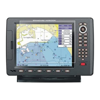
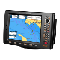
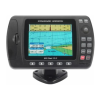
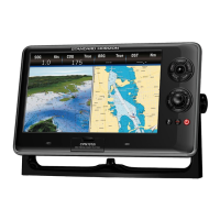
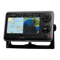
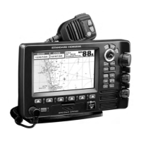
Key features of the CPV350, including GPS chart plotter and marine VHF capabilities.

Packing List

Optional Accessories

Safety and Warning Information

VHF Marine Antenna Installation

Guidelines for installing the VHF marine antenna to meet FCC requirements.

On-Line Warranty Registration

Instructions on how to register the CPV350 Marine VHF online for warranty.

Product Support Inquiries

Information on how to contact product support for technical assistance or inquiries.

FCC Radio License Information

Station License

Details on station licensing requirements for vessels using the radio.

Radio Call Sign

Information on the requirement for a Ship Radio Station License and call sign usage.

Canadian Ship Station Licensing

Information on licensing requirements for vessels operating in Canada.

FCC / Industry Canada Information

Technical data needed for FCC and Industry Canada license applications.

Getting Started

Mounting the GPS Chartplotter

Information on mounting the GPS chartplotter using bracket or flush mounting methods.

Bracket Mounting

Instructions for securely mounting the CPV350 using the provided bracket.

Flush Mounting

Connections

Rear Panel Connections

Identifies and describes the purpose of each connector on the rear panel of the CPV350.

VHF Antenna

Selecting a Marine VHF Antenna

Coaxial Cable

Optional Enhanced Second VHF/PA Station

Remote Mic or External Speaker Selection

NMEA Connections

Outputting NMEA to a Personal Computer

How to output NMEA data (Marks, Routes, Tracks) to PC programs.

Serial PC Connection

Connecting the CPV350 for outputting waypoints and routes to a PC.

Outputting GPS Coordinates

NMEA Data Page

GPS Antenna

Mounting the GPS WAAS Smart Antenna

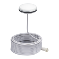
Instructions for mounting the GPS WAAS Smart Antenna for optimal reception.

Mounting on a Pole

Details on mounting the antenna on a pole using standard threads.

Flush Mounting

Steps for flush mounting the GPS WAAS Smart Antenna for a clean installation.

PA Horn Connections

Smart GPS Connector Table

Battery Connections

Optional Black Box Fish Finder

Optional VHF External Speaker

C-MAP MAX Overview

Introduction

Overview of C-MAP MAX evolution and key new data/presentation features.

Inserting the C-Card

Instructions on how to properly insert the C-MAP C-CARD into the unit.

Map Functions

New MAX Functions Menu

How to access the MAX Functions menu to configure chart display options.

Zoom Type

Setting the chart zoom mode between STANDARD and FLEXI-ZOOM.

Fonts & Symbols

Adjusting the size of names and symbols displayed on MAX charts.

Perspective View

Dynamic Nav-Aids

Safety Status Bar (DSI - Data Safety Indicator)

Currents Prediction

Data Features

Pictures & Diagrams

Using C-Map MAX to display pictures or diagrams for cartographic object identification.

How to Show Pictures or Diagrams of a Multimedia Object

Enhanced Port Info

Controls and Indicators

Controls and Connections

Identifies and explains the function of the front panel controls and connections.

The GOTO Key

The MARK/MOB Key

The RTE Key

The PWR Key and Lamp/Contrast

The Soft Keys

Getting Started

Power On, Off and ShuttlePoint Knob Operation

How to power the unit on/off and operate the ShuttlePoint knob.

Cursor Vs. Home Mode

Explains the difference between Cursor Mode and Home Mode for chart navigation.

Cursor and Menu Selection Speed

Changing the Ships Icon

Changing the Backlight and Contrast

Selecting North Up or Course Up

Adjusting the Time

Selecting Loran TD or Other Coordinate System

Changing the Chart Color

Selecting Pages Using Soft Keys

Customizing the Soft Keys

Other Settings in General Setup Menu

Information Page

Using Find Services & More Function

Port Services

How to search for and display port services and contact information.

Other Available Searches

Lists various search functions available via C-MAP, like Port by Name/Distance.

Info on Lakes (with Optional C-MAP Lakes Cartography)

Quick Info On Lakes

Displaying quick information about lakes by clicking on icons.

Full Info On Lakes

Accessing detailed information about lakes and associated fishing data.

Creating Marks

Creating a New Mark Using the Chart Page

Step-by-step guide to creating a new mark directly on the chart page.

Editing a Mark

How to edit an existing mark, including name, icon, and color.

Deleting a Mark or Waypoint

Moving a Mark or Waypoint

Marks/Waypoints List

Creating a New Mark with the Marks/Waypoints List

Goto Cursor

Goto Mark

Man Over Board (MOB) Function

Deleting a MOB Point

How to delete a MOB point from the chart.

Routes

Creating a Route Using Waypoints

Step-by-step guide to creating a route by selecting waypoints on the chart.

Making Additional Routes

Creating a Route Using Marks on the Chart Page

Inserting a Waypoint into a Route

Goto a Route

Other Settings in Route Menu

Tracks

Tracking

Setting up track recording intervals (time or distance) and viewing track points.

Saving and Starting a New Track

Other Settings in Track Menu

Using the Trip Log

Resetting the Trip Log

Procedure to reset the trip log to clear recorded distance and time.

User C-Card

User C-Card Menu

Accessing the menu for managing the User C-CARD.

Formatting the User C-CARD

Steps to format the User C-CARD for preparing it to store data.

Transferring Files to the Optional User C-CARD

Loading a File

Deleting a File from the User C-CARD

Pages

Selection by MENU

How to select display pages using the Main Menu.

Selection by SOFT KEY

How to select display pages using the Soft Keys for quick access.

Chart Page

Window Selections

Customizing the data window layout on the Chart page.

Additional Functions on Chart Page

Turning Off Information on Icon Points

Display Mode

Marine Settings

Depth Settings

Land Settings

Chart Settings

Underwater Objects Settings

Customizing the Data Windows

Customizing Chart Settings

Navigation Page

Highway Page

Celestial Page

GPS Status Page

NMEA Display Page

NMEA Data Page

NMEA Depth, Wind Speed, Temp and SOG Trend Pages

VHF Digital Selective Calling

General

General overview of DSC's purpose in maritime distress and safety.

Position Request

Transmitting a DSC position request to other vessels.

Maritime Mobile Service Identity (MMSI)

Programming the MMSI

Step-by-step instructions for programming the MMSI number into the CPV350.

DSC Distress Call

Transmitting a DSC Distress Call

Detailed procedure for sending a DSC distress call with nature of distress.

Receiving a DSC Distress Call

All Ships Call

Transmitting an All Ships Call

How to transmit an All Ships Call (Urgency or Safety).

Receiving an All Ships Call

Individual Call

Setting up the Individual / Position Call Directory

Programming vessel names and MMSI numbers into the individual call directory.

Setting up Individual Reply

Setting up the Individual/Group Call Ringer

Transmitting an Individual Call

Receiving an Individual Call

Call Waiting Directory

Enabling the Call Waiting Feature

Enabling or disabling the call waiting feature for logged calls.

Reviewing Received Calls Logged into the Call Waiting Directory

How to review logged distress and individual calls in the call waiting directory.

To Delete the Received Log from the "DSC Log" Directory

Group Call

Setting up a Group Call

Programming group MMSI numbers for collective communication.

Transmitting a Group Call

Receiving a Group Call

Position Request

Setting up Position Reply

Configuring automatic or manual position replies to position requests.

Transmitting a Position Request to Another Vessel

Receiving a Position Request

Position Send

Setting up a Position Send Ringer

Enabling or disabling the ringer for position send calls.

Transmitting a DSC Position Send Call

Receiving a DSC Position Send Call

Radio Setup

Channel Name Change

Customizing the names of radio channels.

Unit Name

Enhanced RAM+ Mic Operation

RAM+ Mic Controls

Explanation of the controls and keys on the RAM+ microphone.

[CALL/SET] Key

[DW] Key

[NAV] Key

[WX] Key

[DISTRESS] KEY

PA/FOG Operation

Operating the PA / Hailer

Using the PA/Hailer function for announcements and listen-back.

Operating the FOG Horn

Intercom Operation

Communication

How to establish intercom communication with the VH-310 handset.

DSC/Radio Setup Mode

VH-310 Handset Operation

VH-310 Handset Controls

Explanation of the controls and keys on the VH-310 handset.

[F] Key

[16/9] Key

[WX] Key

[]/[] Key

Keypad

[5(IC)] Key

[6(NAV)] Key

[7(SCRM)] Key

[8(PA)] Key

[9(FOG)] Key

[0] Key

[CLR] Key

[ENT] Key

PA/FOG Operation

Operating the PA / Hailer

Using the PA/Hailer function for announcements and listen-back.

Operating the FOG Horn

Selecting and activating fog horn signals via the VH-310 handset.

Intercom Operation

Communication

How to establish intercom communication with the VH-310 handset.

Manual Inputting of the GPS Location (Lat/Lon)

DSC/Radio Setup Mode

Changing GPS Information to Vessel position or COG

External Speaker AF Selection

Maintenance

Replacement Parts

Information on ordering replacement parts like brackets and knobs.

Factory Service

Troubleshooting

Channel Assignments

Technical Tests

System Test

Running an extended auto-test to help determine operational problems.

RAM Menu (reset)

Verifying RAM integrity and options to clear internal memory and reset defaults.

DIM Menu

Adjusting screen brightness and keypad light.

Cartridges

Serial Ports

Modem test

Warranty

Marine Products Limited Warranty

Terms and duration of the limited warranty for various marine products.

On-Line Warranty Registration

Specifications

CPV350 Specifications

Detailed specifications for the CPV350, including general, transmitter, receiver, and GPS.

General

General specifications like input voltage, current drain, dimensions, and weight.

Transmitter

Transmitter specifications including RF output, modulation, and frequency stability.

Receiver

Receiver specifications such as sensitivity, selectivity, and audio output.

GPS Chart Plotter

GPS chart plotter specifications for user points, routes, tracks, and cartography.

GPS WAAS Smart Receiver Specifications

Appendix: Terms

Related product manuals