34
2. Tap Minimise delays.
Your device looks for the quickest route to your destination.
The new route may also include traffic delays, or may even be the same route as before.
3. Tap Done.
Traffic incidents
Traffic incidents and warnings are shown on the map, in the Driving View and on the Traf-
fic sidebar.
To find out more about an incident, tap Browse Map in the Main Menu. Tap on a traffic
incident symbol on the map to see information about that incident. To display information
about surrounding incidents, use the left and right arrows at the bottom of the screen.
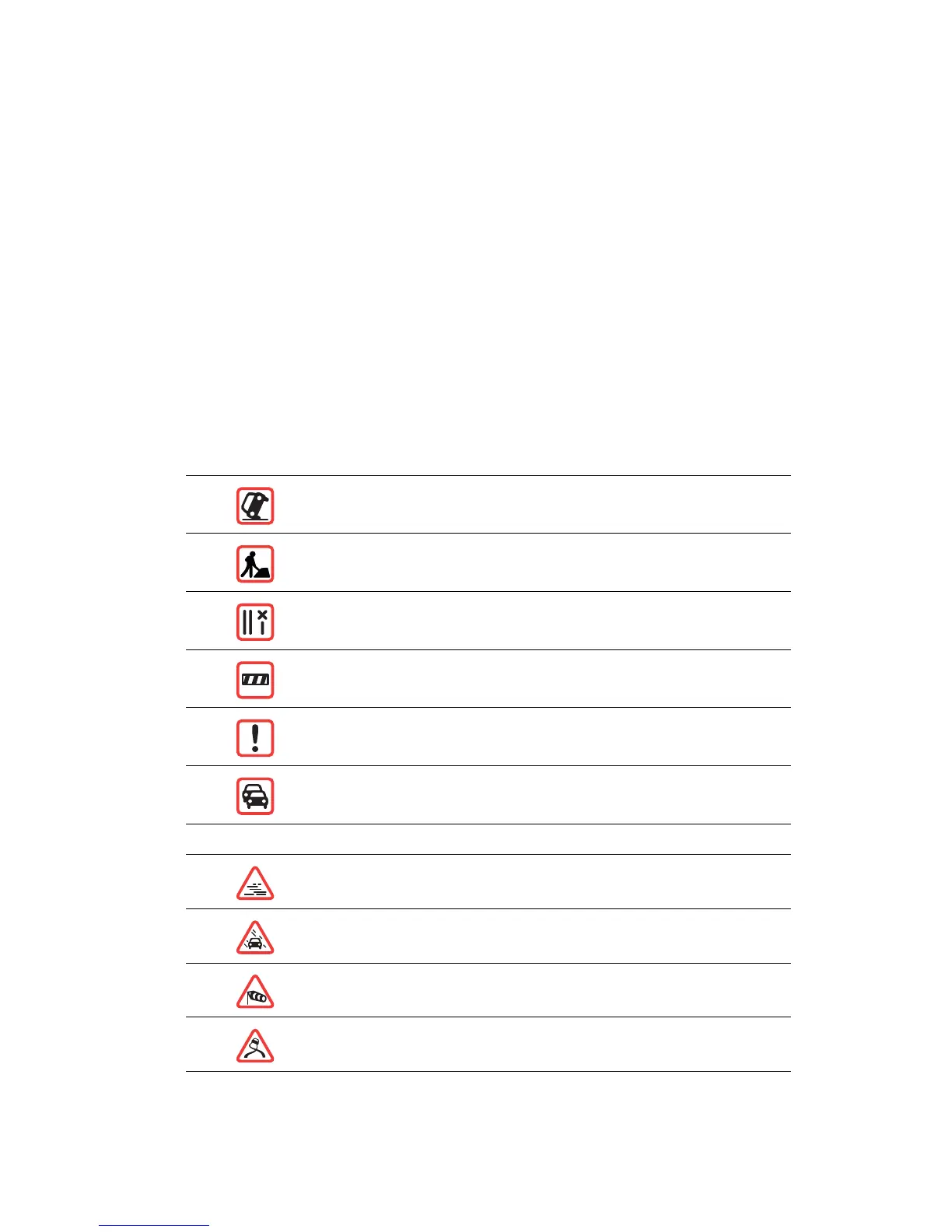
There are two types of incident and warning signs:
• Symbols shown in a red square are traffic incidents. Your navigation device can replan
to avoid them.
• Symbols shown in a red triangle are weather related. Your device does not replan to
avoid these warnings.
Traffic incident symbols and their meaning are shown below:
Weather related symbols and their meaning are shown below:
Accident
Road works
One or more lanes closed
Road closed
Traffic incident
Traffic jam
Fog
Rain
Wind
Ice