Do you have a question about the Topcon ES-103 and is the answer not in the manual?
Details general safety warnings related to handling the instrument, carrying case, and accessories.
Outlines safety precautions for battery chargers, batteries, power cords, and handling.
Warns about hazardous radiation exposure from controls or procedures not specified in the manual.
Advises on safe laser beam handling, power off procedures, and user training requirements.
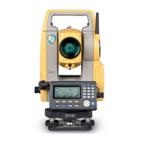
Explains fundamental key operations like power, display lighting, target switching, and laser pointer.
Provides instructions and precautions for charging the instrument's battery correctly.
Details the steps for safely installing and removing the instrument battery, ensuring protection.
Explains how to center the instrument over the survey point using optical or laser plummet.
Describes the method for leveling the instrument using tripod legs and leveling screws.
Guides through setting up the instrument's Bluetooth communication mode to Slave or Master.
Details Bluetooth communication steps when the ES acts as slave or master device.
Explains how to perform measurements using a data collector via Bluetooth communication.
Describes how to enter known point data or output JOB data wirelessly via Bluetooth.
Explains how to perform simultaneous distance and angle measurements.
Explains the Remote Measurement (REM) function for measuring heights of inaccessible points.
Guides through entering station coordinates, instrument height, target height, and azimuth angle.
Guides through measuring known points to determine instrument station coordinates via resection.
Explains how to determine only the Z (height) coordinate of the instrument station using resection.
Explains how to measure and calculate the 3D coordinates of a target based on station data.
Guides through setting out points using coordinate data, calculating angles and distances.
Explains how to set out points based on horizontal angle and distance from a reference.
Details setting-out for inaccessible points using the REM function.
Explains how to define a baseline, either by inputting coordinates or observing points.
Explains finding point coordinates by inputting length and offset based on a baseline.
Measures horizontal and vertical distance of a point from a connected line or baseline.
Explains how to define an arc by inputting parameters like radius and coordinates, or by observation.
Explains finding required point coordinates along an arc by inputting arc length and offset.
Explains how to define a baseline, which is essential for performing point projection.
Details how to perform point projection by defining a baseline and entering point coordinates.
Details the steps for performing topography observations, including measuring directions and recording data.
Explains finding a point by entering horizontal distance from a target point to an offset point.
Details finding a target point's direction using included angles and offset points.
Explains measuring distances between a target and two offset points for finding the target.
Guides on finding distance and coordinate of a plane edge where direct measuring is difficult.
Explains finding the center of a column and its coordinates by measuring circumscription points.
Explains measuring distances and angles between points without moving the instrument.
Explains finding intersection points between reference points using length or azimuth angle.
Explains how to display traverse precision and perform angular, coordinate, and elevation adjustments.
Details the Compass, Transit, and Weighted methods for distributing coordinate and angular errors.
Guides on calculating center and width pegs for a straight line based on reference and IP points.
Explains finding center and width pegs for a circular curve using BC and IP point coordinates.
Details calculation of center and width pegs for a spiral (clothoid) curve based on reference and curve properties.
Explains calculation of center and width pegs for a parabola based on reference and curve properties.
Finds coordinates of cardinal points, centerline, and width pegs using 3 IP points and curve properties.
Calculates cardinal points and pegs using intersection angle, curve properties, and IP point data.
Finds center and width pegs for a route with multiple curves, enabling setting-out operations.
Guides through automatic calculation of cardinal points based on input curve properties.
Explains finding coordinates of arbitrary points on calculated curves using calculation.
Explains finding route widths and coordinates for center pegs using inverse width peg calculation.
Guides on setting a baseline by defining a line connecting two points for point-to-line analysis.
Explains defining target point coordinates by measuring points on a defined baseline.
Details how to record instrument station data, including coordinates, point name, and other parameters.
Explains how to record backsight station data, including azimuth angle calculation.
Explains how to record angle measurement data, including target height, point name, and code.
Describes how to record distance measurement data, including target height, point name, and code.
Explains how to record coordinate measurement data, including target height, point name, and code.
Details how to record both distance and coordinate data simultaneously for the same point.
Guides on selecting the current JOB and the Coordinate Search JOB for data management.
Guides on registering or deleting coordinate data for known points using key entry or external input.
Guides on outputting JOB data to a host computer via USB or other means.
Explains Config Mode settings: Observation, Instrument, Comms, Unit, and Key functions.
Covers settings for wireless communication: baud rate, data bits, parity, stop bits, ACK/NAK, and ACK mode.
Guides on allocating functions to softkeys for efficient instrument operation and saving allocations.
Explains methods for restoring the instrument to its factory default settings.
Details power source, working duration, battery indicator, auto power-off, external source, and charging time.
| Brand | Topcon |
|---|---|
| Model | ES-103 |
| Category | Measuring Instruments |
| Language | English |