English
29
6 Diving in mountain lakes
III UWATEC Aladin TEC 2G
III
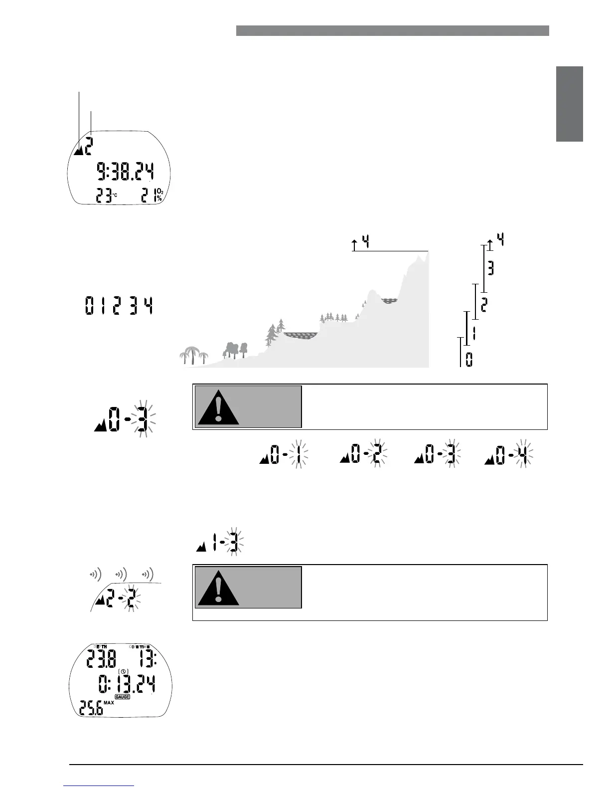
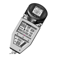
Altitude range 2
Altitude icon
Altitude ranges
6.3 Prohibited altitude
Aladin shows via flashing alti
tude segments while at
the surface to which altitude
the diver may not rise.
The ascent prohibition can also be displayed together with an altitude range:
Example: You are at 1200m (3937ft) (altitude range 1) and you
may ascend to range 2 only (2650m / 8694ft). You may not rise
to the altitude range 3 or 4.
If an ascent to a prohibited altitude is detected, an
audible alarm goes off for 1 minute (patent pend-
ing).
Descend to a lower altitude.
Ascent to altitude range 3
and 4 prohibited.
Max allowed altitude:
2650m (8694ft).
6.4 Decompression dives in mountain lakes
In order to assure optimal decompression even at higher altitudes, the 3m
(10ft) decompression stage is divided into a 4m (13ft) stage and a 2m (7ft)
stage in altitude ranges 1, 2 and 3. The prescribed decompression stop depths
are, in sequence, 2m / 4m / 6m / 9m… (7ft / 13ft / 20ft / 30ft…).
If atmospheric pressure is below 620mbar (8.99psi) (altitude higher than
4100m / 13450ft above sea level), Aladin switches automatically to gauge
mode and no decompression data is calculated and displayed.
In addition, the dive planner is not available anymore.
6.1 Altimeter
The altitude adjustment ->45
does not affect altitude ranges nor any calculations.
6.2 Altitude ranges Aladin measures the atmospheric pressure every 60 seconds even while the
display is switched off. If the computer detects a sufficient increase in altitude,
it switches on automatically and indicates the new altitude range (1-4) and
the desaturation time. Desaturation time indicated at this moment refers to
adaptation time at this altitude. If the dive starts within this adaptation time,
Aladin treats it as a repetitive dive, since the body is offgassing.
Altitude is divided into five ranges, which are influenced by barometric pres-
sure. That is why the defined altitude ranges overlap on their fringes. If a
mountain lake is reached, the altitude range is indicated at the surface (time
of day display), in the logbook and in the dive planner by a stylised mountain
and the current altitude range.
Sea level to an altitude of approximately
1000m
(3300ft) is not indicated. In the following
diagram, you can see the
approximate breakdown
of the altitude ranges
: