102
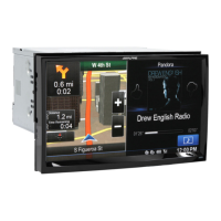
Select which Places to show on the map while
navigating. Too many Places make the map crowded
so it is a good idea too keep as few of them on the
map as possible. For this, you have the possibility to
save different Place visibility sets. You have the
following possibilities:
Tap the checkbox to show or hide the Place
category.
Tap the name of the Place category to open
the list of its subcategories.
Tap to save the current
Place visibility set or to load a previously saved
one. Here you can also revert to the default
visibility settings.
5.3.6 Visual guidance settings
Adjust how the software helps you navigate with different kinds of route
related information on the Map screen.
The data fields in the corner of the Map screen can be
customised. Tap this button and select the values you
want to see. The values can be different when you
navigate a route from when you are just cruising
without a given destination. You can select general
trip data like your current speed or the altitude, or
route data related to your final destination or the next
waypoint on your route.
You may need a petrol station or a restaurant during
your journey. This feature displays a new button on
the map when you are driving on motorways. Tap this
button to open a panel with the details of the next few
exits or service stations. Tap any of them to display it
on the map and add it as a waypoint to your route if
needed.
Select the service types displayed for the motorway
exists. Choose from the POI categories.
Alpine_X009E_B5.pdf 102 5/9/2014 14:22:26