EN
6
6. Flight
For a safe take-off, make sure that the Aircraft Status Indicators blink green slowly (using RTK* or GNSS
for positioning).
The following example includes instructions for 3D Map Area missions using DJI GS Pro.
* RTK positioning is recommended. Go to Mission View in DJI GS Pro, tap the icon or RTK on top of the screen to
go to the RTK settings menu, and then select D-RTK 2 or Network RTK Account as the RTK data source. Enable the
aircraft RTK at the bottom of the menu. Otherwise, the aircraft cannot use the RTK data.
* When multispectral camera has been selected in Camera View, this mission will not include RGB photos.
7. Starting Operations
Create a 3D Map
Area mission.
Generate a map.Export the
pictures.
Perform the
mission.
Tap camera preview to enter
Camera View to configure
camera settings*.
Configure mission
parameters.
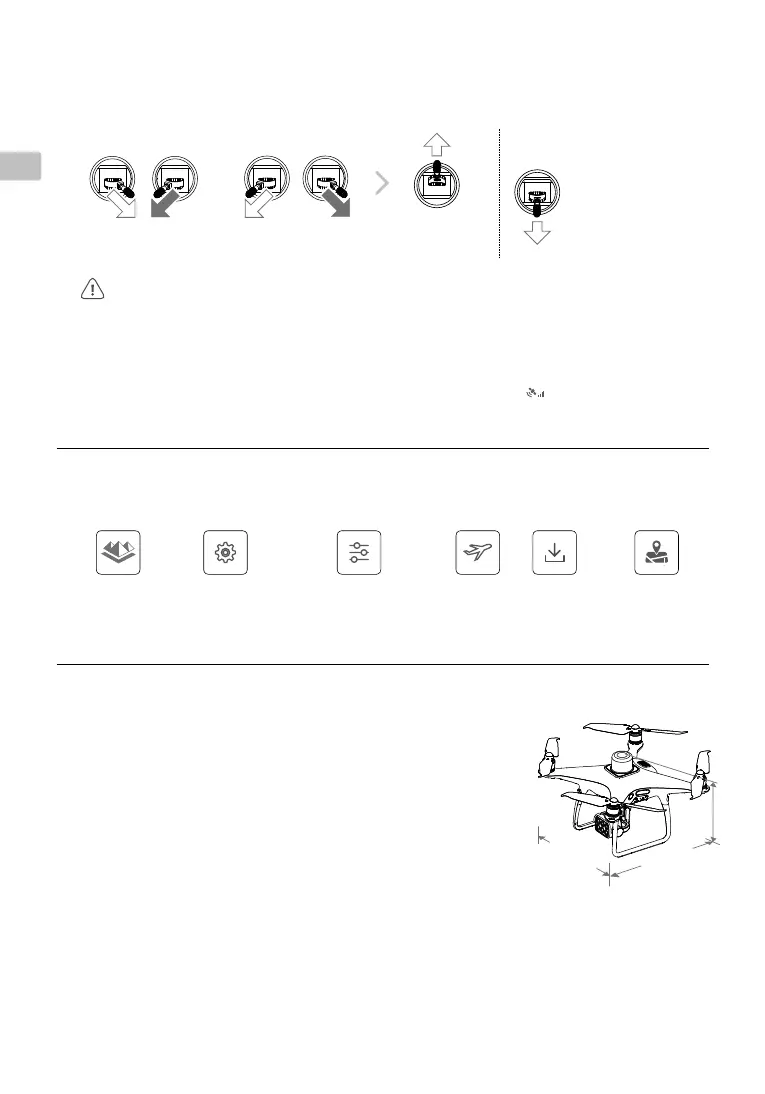
Takeoff Landing
OR
Combination Stick Command to
start/stop the motors
Left stick (in Mode 2)
up slowly to take off
Left stick down slowly
until you touch the
ground
Hold for three seconds
to stop the motors
●
Spinning propellers can be dangerous. Stay away from spinning propellers and motors. DO NOT start the
motors in confined spaces or when there are people nearby.
●
Always keep your hands on the remote controller when the motors are spinning.
●
Stopping motors mid-ight: Perform the CSC to stop the motors. This function can be enabled in DJI GS
Pro. Only stop motors mid-ight in emergency situations when doing so can reduce the risk of damage or
injury.
●
Aircraft
Takeoff Weight 1487 g
Diagonal Distance (Propellers Excluded) 350 mm
Max Service Ceiling Above Sea Level 19685 ft (6000 m)
Max Ascent Speed 6 m/s (automatic ight); 5 m/s (manual control)
Max Descent Speed 3 m/s
Max Speed 31 mph (50 kph) (P-mode); 36 mph (58 kph) (A-mode)
Max Flight Time Approx. 27 minutes
Operating Temperature 0° to 40° C (32° to 104° F)
Operating Frequency 2.4000 GHz to 2.4835 GHz (Europe, Japan, Korea)
5.725 GHz to 5.850 GHz (Other countries/regions)
[1]
Transmission Power (EIRP) 2.4 GHz: < 20 dBm (CE / MIC / KCC)
5.8 GHz: < 26 dBm (FCC / SRRC / NCC)
Hover Accuracy Range RTK enabled and functioning properly:
Vertical: ±0.1 m; Horizontal: ±0.1 m
RTK disabled:
Vertical: ±0.1 m (with vision positioning); ±0.5 m (with GNSS positioning)
Horizontal: ±0.3 m (with vision positioning); ±1.5 m (with GNSS positioning)
Image Position Compensation The relative positions of the centers of the six cameras’ CMOS and the phase center of the
onboard D-RTK antenna have been calibrated and are recorded in the EXIF data of each image.
●
GNSS
Single-Frequency High-Sensitivity GNSS GPS + BeiDou + Galileo
[2]
(Asia); GPS + GLONASS + Galileo
[2]
(other regions)
Specications
2
8
9.5 mm
289
.
5
m
m
213 mm