11
Make a Map
• Once your ight is complete, take the
Micro SD card out of your drone and
put it into your computer (you may
need an Micro SD card adapter to do
this). Then login to your account on
www.dronedeploy.com
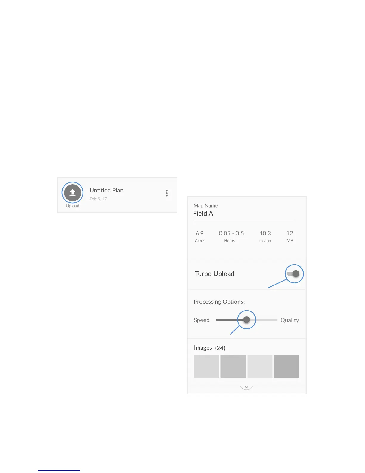
• Find your ight plan - the icon should
be blue with the text ‘Upload’ - open
the plan to begin the process. and
click the upload buon.
• Keep the Terrain vs Structures buon
on the “Terrain” seng.
• Click on “Select Photos”, and then
select all of the photos from your
ight on the SD card. Make sure to
only include photos taken as part of
your mapping ight. Photos of the
horizon or of unrelated scenes can
confuse the processing soware.
• Select your uploading and processing
opons. For most crop mapping,
use the middle processing opon,
but if you plan to use your map for
plant counng, stand counng or
measuring volumes, we recommend
the highest quality opon.
• Leave your computer on, with the
DroneDeploy tab open (if you change
tabs some web browsers limit the
bandwidth and computer resources
for the tab which will cause uploads
to fail).
• Once the upload is complete, you
may close the tab and shutdown your
computer.
• You’ll receive an email from
DroneDeploy leng you know when
your map is complete.

 Loading...