The XGPS DashPro is a Bluetooth® GNSS Receiver developed by Dual Electronics, leveraging Swift Navigation's Skylark™ Precise Positioning Service to deliver centimeter-level location accuracy. This device is designed to provide highly accurate positioning data to mobile devices, surpassing the precision typically offered by native phone or tablet GNSS capabilities. It connects to smartphones, tablets, and other computing devices running Android or iOS® via Bluetooth, and its generated location data can be utilized by any location-based application on the connected mobile device.
Function Description:
The primary function of the XGPS DashPro is to act as an external, high-precision GNSS receiver. It processes signals from various satellite systems worldwide to determine its precise location. This location data is then transmitted wirelessly via Bluetooth to a paired mobile device. The accompanying DashPro app facilitates the routing of this precise location data to other location-based applications on the mobile device, ensuring that these apps benefit from the enhanced accuracy provided by the DashPro.
A key feature of the XGPS DashPro is its integration with Swift Navigation's Skylark™ Precise Positioning Service. To achieve centimeter-level accuracy, users must connect to and activate a Skylark subscription through the DashPro app. The device also supports NTRIP (Networked Transport of RTCM via Internet Protocol) for receiving correction data from other NTRIP-based correction services, including Skylark and Skylark RTK.
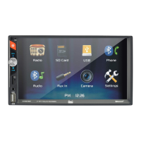
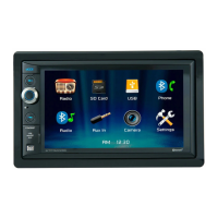
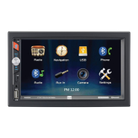
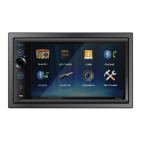
The DashPro app serves as a central interface for managing the device and its data. It allows users to:
- Monitor the XGPS DashPro's operation, including its generated position and satellite tracking information.
- Configure various operational settings of the DashPro.
- Route precise location data to other location-based apps on the connected device.
- Connect to and receive Skylark corrections, or configure NTRIP settings for other correction services.
Important Technical Specifications (Derived from LED Indicator and App Settings):
- Connectivity: Bluetooth for data transmission to mobile devices; USB-C for charging and direct data communication.
- GNSS Constellations: Supports GPS, Galileo, and BeiDou satellite systems for positioning.
- Positioning Accuracy: Capable of centimeter-level accuracy when connected to Skylark corrections.
- Fix Types: Supports various fix types including No Fix, SPP Fix, SBAS, RTK Float, RTK Fixed, and DR (Dead Reckoning). The device automatically attempts to achieve the best possible fix type.
- Battery: Rechargeable via USB-C. LED indicator shows charging status (solid red) and low battery (blink 2 times, short break).
- Firmware: Updatable via the DashPro app.
- Data Logging:
- Logging Interval: Configurable from every 0.1 to every 20 seconds.
- Memory Management: Options to overwrite old log data or stop recording when memory is full.
- Streaming Rate: Configurable output rate for position data (e.g., 1Hz).
- Streaming Format: NMEA (National Marine Electronics Association) is a supported output format.
- Position Display Formats: Latitudinal and longitudinal values can be displayed in Degrees, Minutes, Seconds (DD°MM'SS"), Degrees, Decimal Minutes (DD°MM.MM'), or Decimal Degrees (DD.DDDD°).
- Speed Display Units: Knots, miles per hour (mph), or kilometers per hour (kph).
- Altitude Display Units: Feet or meters.
Usage Features:
- Power On/Off: Firmly press and hold the power button for one second.
- Pairing:
- First-time Pairing: Power on the DashPro (LED flashes blue), access Bluetooth settings on the mobile device, and select "DashPro-[XXXXXX]" from the available devices list.
- Subsequent Pairing: The DashPro automatically reconnects to the last paired device. If not, manually select it from the Bluetooth setup screen.
- Skylark Activation: Within the DashPro app, navigate to Settings > Corrections Setup > Skylark tab, and toggle "Connect to Skylark" to activate the subscription.
- NTRIP Configuration: In the DashPro app, navigate to Settings > Corrections Setup > NTRIP tab. Enter End Point, Mount Point, Port, User Name, and Password details, then select "Connect to Service."
- Routing Location Data (Android): Requires Developer Mode to be enabled on the Android device. In the DashPro app Settings, select "Use XGPS DashPro Position," which opens Developer Options. Then, select "DashPro" under "Select Mock Location App."
- Routing Location Data (iOS): As an Apple MFI certified product, the DashPro automatically provides location data to any app requiring it once connected, without additional setup.
- Status Screen: Provides real-time information on device status (connecting device, battery, firmware version) and position information (latitude, longitude, altitude, UTC, heading, speed, correction age, fix type, NTRIP data received).
- Satellites Screen: Displays a sky plot of tracked satellites (GPS, Galileo, BeiDou) and their signal strengths. Users can toggle which constellations are displayed. It also shows the average SNR of satellites used and the total number of satellites used for the position solution.
- Trips Screen: Allows management of logged data (trips). Displays a list of trip files with date and duration, and the percentage of storage used.
- Trip File Details: When a trip is selected, it shows name (editable), start/stop times, duration, data points, and average speed.
- Trip File Actions: Delete from DashPro, Save to App, Map (display on map), Share (send to others).
- Mark & Trace Screen:
- Tracking Position: Displays current latitude and longitude.
- Marking Points: Click the Map Pinpoint button, drag the map to the desired location, press the Mark icon, enter a name, and click OK.
- Accessing Marked Points: Click the menu icon (top-right) to view a list of saved positions. Select a position to center the map on it.
- Distance to Marked Point: Activate a marked point to see the "crow flies" distance from the current position to the marked point, along with its name, latitude, and longitude.
- Deleting Marked Points: Activate a marked point, then click and hold its name. Confirm deletion in the dialog box.
- Sharing Saved Positions: From the Mark & Trace screen, click the menu icon, then the share icon, and select a method to share the CSV file of saved positions.
- Viewing in Google Maps: Click a saved position marker or select from the list, then click the Google Maps icon to open the location in Google Maps.
- Directions in Google Maps: Click a saved position marker or select from the list, then click the directions icon to get directions from the current DashPro position to the saved location.
- Settings Screen: Configures display options (speed units, altitude units, position formats) and device behavior (automatic logging, memory full actions, streaming rate/format, logging interval). Also includes the "Use XGPS DashPro Position" toggle for Android and a "Corrections Setup" button.
- Information Screen: Accessible via the "i" button (top-right of any screen), it provides a description of the DashPro app and its current version.
Maintenance Features:
- Charging: The device is charged via a USB-C connection. A solid red LED indicates charging is in progress, and the light turns off when fully charged.
- Firmware Updates: The DashPro app allows users to check for and install newer firmware versions for the device, ensuring optimal performance and access to the latest features.
- Troubleshooting (LED Indicators):
- Red Solid: Battery charging.
- Red Blink 2 times, short break: Low battery (below 10%).
- Red Constant fast blink: Battery or charger fault; service required.
- Green Solid: GNSS location fixed.
- Green Fast blink: GNSS configuration in progress (receiver booting).
- Green Slow blink: GNSS fix lost.
- Blue Solid: At least 1 Bluetooth device connected.
- Blue Fast blink: iOS handshake in progress, unrecoverable error in Bluetooth.
- Blue Slow blink 50% on: Trying to restore last Bluetooth connection.
- Blue Slow blink 10% on: Bluetooth idle.
- Orange Solid or Slow blink: Logging active, or firmware installation in progress.
The XGPS DashPro is a robust and user-friendly device designed for professionals and enthusiasts who require highly accurate positioning data for various applications, from navigation to data logging. Its seamless integration with mobile devices and correction services makes it a powerful tool for precise location-based tasks.