Do you have a question about the Eagle IntelliMap 500C and is the answer not in the manual?
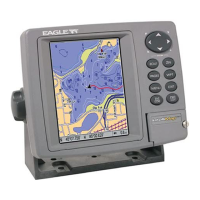
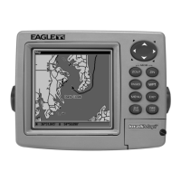
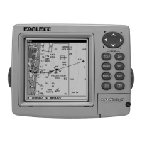
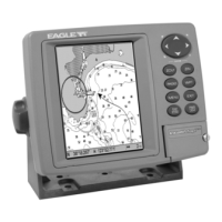
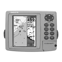
Details the IntelliMap 500C's technical features, display, resolution, and power requirements.
Explains the fundamental principles of GPS satellite navigation technology and how the unit receives signals.
Provides an overview of Global Positioning System (GPS) and WAAS functionality for enhanced accuracy.
Covers essential steps and considerations before installing the GPS unit and accessories.
Details the installation of the GPS antenna/receiver module and proper power hookups.
Provides instructions for mounting the GPS unit using gimbal brackets, in-dash kits, or portable options.
Guides users on inserting and managing MMC or SD cards for storing custom maps and GPS data.
Explains the function of each key on the unit and navigation of main menus and pages.
Describes the three main page screens: Satellite Status, Navigation, and Map displays.
Covers map data, zooming, scrolling, and window resizing for better visualization.
A concise step-by-step guide for essential GPS operations and navigation tasks.
Instructions for measuring distances, navigating to points, icons, and POIs.
Covers creating, saving, editing, and navigating waypoints, routes, and trails.
Explains how to create, delete icons and use utility functions like alarm clock and calculators.
Configuration of arrival, off-course, and anchor alarms with customizable distance settings.
Adjusting communications, NMEA, coordinate systems, display, language, and time settings.
Customizing map data, overlays, datums, categories, and Navionics charts.
Customizing trail update criteria, visibility, and managing saved trails.
Introduces the unit's search capabilities for various map items like addresses, POIs, and exits.
Step-by-step guide to search for specific addresses, streets, and intersections.
How to search for Points of Interest (POIs) by nearest location or name.
Lists the various geodetic datums supported by the GPS unit for accurate positioning.
Details compliance with Federal Communications Commission rules and regulations for device operation.
| Display Size | 5 inches |
|---|---|
| Display Resolution | 480 x 272 pixels |
| Waterproof Rating | IPX7 |
| Preloaded Maps | Yes |
| Waterproof | Yes |
| Touchscreen | Yes |
| Display Type | TFT LCD |
| Receiver Type | High-sensitivity GPS |